Kautzen geodata
Kautzen (Lower Austria) is a seat of a third-order administrative division; located in Austria in Europe/Vienna (GMT+2) time zone. With population of 589 people, there are 2170 cities with bigger population in this country. Compared to other cities in Austria, 99.9% of cities are located further ↓South; 58.6% of cities are located further ←West and 60.6% of cities have lower elevation than Kautzen. Note1
Administrative division(s):
- Level 1: Lower Austria
- Level 2: Politischer Bezirk Waidhofen an der Thaya
- Level 3: Kautzen


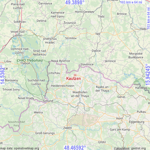
Kautzen GPS coordinates[2]
48° 55' 48" North, 15° 14' 21.552" East
| Map corner | latitude | longitude |
|---|---|---|
| Upper-left | 49.3898°, | 14.5362° |
| Center: | 48.93°, | 15.23932° |
| Lower-right: | 48.46592°, | 15.94245° |
| Map W x H: | 102.7×102.7 km | = 63.8×63.8mi |
| max Lat: | 48.98333° ⇑0.1% North |
| Kautzen: | 48.93° |
| min Lat: | ⇓99.9% South 46.48841° |
| min Long | Kautzen | max Long |
| 9.57802° | 15.23932° | 17.1° |
| W 58.6%⇐ | ⇒41.4% E |
Elevation
Elevation of Kautzen is 521 m = 1709 ft, and this is 15.5 m = 51 ft above average elevation for this country.
| Max E: |
2140 m = 7021 ft | 39.4% |
| Kautzen | 521 m 1709 ft | |
| Avg. | 505.5 m = 1658 ft | |
Min E: |
118 m = 387 ft | 60.6% |
See also: Austria elevation on elevation.city.
Geographical zone
Kautzen is located in North temperate zone (between Tropic of Cancer and the Arctic Circle). Distance of this North polar circle is 1960.7 km =1218.3 mi to North.| Distance of | km | miles | from Kautzen |
|---|---|---|---|
| North Pole | 4566.6 | 2837.6 | to North |
| Arctic Circle | 1960.7 | 1218.3 | to North |
| Tropic Cancer | 2834.6 | 1761.3 | to South |
| Equator | 5440.5 | 3380.6 | to South |


Nearby cities:
15 places around Kautzen: (largest is in red/bold)
• Alt-Dietmanns
18.6 km =11.6 mi,  145°
145°
• Amaliendorf
15.7 km =9.8 mi,  226°
226°
• Dobersberg
6.3 km =3.9 mi,  105°
105°
• Eggern
7 km =4.3 mi,  249°
249°
• Eisgarn
10.1 km =6.3 mi,  261°
261°
• Gastern
4.2 km =2.6 mi,  199°
199°
• Haugschlag
15 km =9.3 mi,  293°
293°
• Heidenreichstein
11.4 km =7.1 mi, 231°
• Karlstein
12.8 km =8 mi, 113°
• Litschau
14.3 km =8.9 mi,  276°
276°
• Reingers
8.7 km =5.4 mi,  297°
297°
• Thaya
9.1 km =5.7 mi,  156°
156°
• Waidhofen an der Thaya
13 km =8.1 mi,  165°
165°
• Waldkirchen an der Thaya
8.1 km =5 mi,  87°
87°
• Windigsteig
18.4 km =11.4 mi, 169°
Sources, notices
• [Note1] Compared only with cities in Austria existing in our database
• [Src1] Map data: © OpenStreetMap contributors (CC-BY-SA)
• [Src2] Other city data from geonames.org with taken over terms of usage.
• [Src3] Geographical zone / Annual Mean Temperature by Robert A. Rohde @ Wikipedia
