Thaya geodata
Thaya (Lower Austria) is a seat of a third-order administrative division; located in Austria in Europe/Vienna (GMT+2) time zone. With population of 611 people, there are 2099 cities with bigger population in this country. Compared to other cities in Austria, 99.6% of cities are located further ↓South; 60.1% of cities are located further ←West and 55.2% of cities have lower elevation than Thaya. Note1
Administrative division(s):
- Level 1: Lower Austria
- Level 2: Politischer Bezirk Waidhofen an der Thaya
- Level 3: Thaya


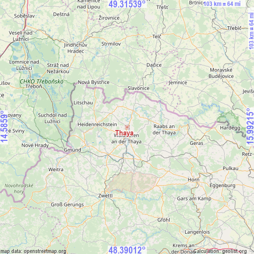
Thaya GPS coordinates[2]
48° 51' 17.604" North, 15° 17' 20.472" East
| Map corner | latitude | longitude |
|---|---|---|
| Upper-left | 49.31539°, | 14.5859° |
| Center: | 48.85489°, | 15.28902° |
| Lower-right: | 48.39012°, | 15.99215° |
| Map W x H: | 102.9×102.9 km | = 63.9×63.9mi |
| max Lat: | 48.98333° ⇑0.4% North |
| Thaya: | 48.85489° |
| min Lat: | ⇓99.6% South 46.48841° |
| min Long | Thaya | max Long |
| 9.57802° | 15.28902° | 17.1° |
| W 60.1%⇐ | ⇒39.9% E |
Elevation
Elevation of Thaya is 486 m = 1594 ft, and this is 19.5 m = 64 ft below average elevation for this country.
| Max E: |
2140 m = 7021 ft | 44.8% |
| Avg. | 505.5 m = 1658 ft | |
| Thaya | 486 m = 1594 ft | |
Min E: |
118 m = 387 ft | 55.2% |
See also: Austria elevation on elevation.city.
Geographical zone
Thaya is located in North temperate zone (between Tropic of Cancer and the Arctic Circle). Distance of this North polar circle is 1969 km =1223.5 mi to North.| Distance of | km | miles | from Thaya |
|---|---|---|---|
| North Pole | 4574.9 | 2842.7 | to North |
| Arctic Circle | 1969 | 1223.5 | to North |
| Tropic Cancer | 2826.2 | 1756.1 | to South |
| Equator | 5432.2 | 3375.4 | to South |


Nearby cities:
15 places around Thaya: (largest is in red/bold)
• Alt-Dietmanns
9.8 km =6.1 mi,  134°
134°
• Amaliendorf
15.2 km =9.4 mi,  260°
260°
• Dobersberg
7.1 km =4.4 mi,  19°
19°
• Eggern
11.8 km =7.3 mi,  300°
300°
• Eisgarn
15.2 km =9.4 mi, 296°
• Gastern
6.7 km =4.2 mi,  311°
311°
• Groß-Siegharts
11 km =6.8 mi, 129°
• Heidenreichstein
12.7 km =7.9 mi,  275°
275°
• Karlstein
8.7 km =5.4 mi,  68°
68°
• Kautzen
9.1 km =5.7 mi,  336°
336°
• Schwarzenau
12.5 km =7.8 mi,  190°
190°
• Vitis
13.1 km =8.1 mi,  216°
216°
• Waidhofen an der Thaya
4.3 km =2.7 mi, 185°
• Waldkirchen an der Thaya
9.8 km =6.1 mi,  27°
27°
• Windigsteig
9.8 km =6.1 mi,  182°
182°
Sources, notices
• [Note1] Compared only with cities in Austria existing in our database
• [Src1] Map data: © OpenStreetMap contributors (CC-BY-SA)
• [Src2] Other city data from geonames.org with taken over terms of usage.
• [Src3] Geographical zone / Annual Mean Temperature by Robert A. Rohde @ Wikipedia
