Amaliendorf geodata
Amaliendorf (Lower Austria) is a populated place; located in Austria in Europe/Vienna (GMT+2) time zone. With population of 733 people, there are 1767 cities with bigger population in this country. Compared to other cities in Austria, 99.5% of cities are located further ↓South; 55.5% of cities are located further ←West and 66.4% of cities have lower elevation than Amaliendorf. Note1
Administrative division(s):
- Level 1: Lower Austria
- Level 2: Politischer Bezirk Gmünd
- Level 3: Amaliendorf-Aalfang


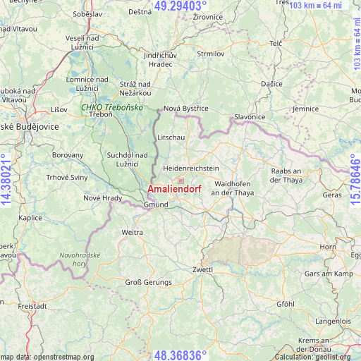
Amaliendorf GPS coordinates[2]
48° 49' 59.988" North, 15° 4' 59.988" East
| Map corner | latitude | longitude |
|---|---|---|
| Upper-left | 49.29403°, | 14.38021° |
| Center: | 48.83333°, | 15.08333° |
| Lower-right: | 48.36836°, | 15.78646° |
| Map W x H: | 102.9×102.9 km | = 63.9×63.9mi |
| max Lat: | 48.98333° ⇑0.5% North |
| Amaliendorf: | 48.83333° |
| min Lat: | ⇓99.5% South 46.48841° |
| min Long | Amaliendorf | max Long |
| 9.57802° | 15.08333° | 17.1° |
| W 55.5%⇐ | ⇒44.5% E |
Elevation
Elevation of Amaliendorf is 561 m = 1841 ft, and this is 55.5 m = 182 ft above average elevation for this country.
| Max E: |
2140 m = 7021 ft | 33.6% |
| Amaliendorf | 561 m 1841 ft | |
| Avg. | 505.5 m = 1658 ft | |
Min E: |
118 m = 387 ft | 66.4% |
See also: Austria elevation on elevation.city.
Geographical zone
Amaliendorf is located in North temperate zone (between Tropic of Cancer and the Arctic Circle). Distance of this North polar circle is 1971.4 km =1225 mi to North.| Distance of | km | miles | from Amaliendorf |
|---|---|---|---|
| North Pole | 4577.3 | 2844.2 | to North |
| Arctic Circle | 1971.4 | 1225 | to North |
| Tropic Cancer | 2823.8 | 1754.6 | to South |
| Equator | 5429.8 | 3373.9 | to South |


Nearby cities:
15 places around Amaliendorf: (largest is in red/bold)
• Altnagelberg
6.4 km =4 mi,  286°
286°
• Eggern
9.6 km =6 mi,  29°
29°
• Eisgarn
9.4 km =5.8 mi,  8°
8°
• Gastern
12.1 km =7.5 mi,  55°
55°
• Gmünd
10.4 km =6.5 mi,  226°
226°
• Heidenreichstein
4.4 km =2.7 mi, 33°
• Hirschbach
10.5 km =6.5 mi,  162°
162°
• Hoheneich
7.9 km =4.9 mi,  210°
210°
• Kirchberg am Walde
12.1 km =7.5 mi,  178°
178°
• Litschau
12.6 km =7.8 mi,  347°
347°
• Schrems
5.7 km =3.5 mi,  192°
192°
• Thaya
15.2 km =9.4 mi,  80°
80°
• Vitis
11 km =6.8 mi,  138°
138°
• Waidhofen an der Thaya
14.8 km =9.2 mi,  97°
97°
• Waldenstein
12.7 km =7.9 mi,  203°
203°
Sources, notices
• [Note1] Compared only with cities in Austria existing in our database
• [Src1] Map data: © OpenStreetMap contributors (CC-BY-SA)
• [Src2] Other city data from geonames.org with taken over terms of usage.
• [Src3] Geographical zone / Annual Mean Temperature by Robert A. Rohde @ Wikipedia
