Brandenberg geodata
Brandenberg (Tyrol) is a seat of a third-order administrative division; located in Austria in Europe/Vienna (GMT+2) time zone. With population of 1,158 people, there are 1092 cities with bigger population in this country. Compared to other cities in Austria, 54.1% of cities are located further ↑North; 89.1% of cities are located further →East and 91.9% of cities have lower elevation than Brandenberg. Note1
Administrative division(s):
- Level 1: Tyrol
- Level 2: Politischer Bezirk Kufstein
- Level 3: Brandenberg


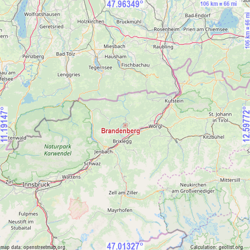
Brandenberg GPS coordinates[2]
47° 29' 25.908" North, 11° 53' 40.524" East
| Map corner | latitude | longitude |
|---|---|---|
| Upper-left | 47.96349°, | 11.19147° |
| Center: | 47.49053°, | 11.89459° |
| Lower-right: | 47.01327°, | 12.59772° |
| Map W x H: | 105.7×105.7 km | = 65.7×65.7mi |
| max Lat: | 48.98333° ⇑54.1% North |
| Brandenberg: | 47.49053° |
| min Lat: | ⇓45.9% South 46.48841° |
| min Long | Brandenberg | max Long |
| 9.57802° | 11.89459° | 17.1° |
| W 10.9%⇐ | ⇒89.1% E |
Elevation
Elevation of Brandenberg is 918 m = 3012 ft, and this is 412.5 m = 1353 ft above average elevation for this country.
| Max E: |
2140 m = 7021 ft | 8.1% |
| Brandenberg | 918 m 3012 ft | |
| Avg. | 505.5 m = 1658 ft | |
Min E: |
118 m = 387 ft | 91.9% |
See also: Austria elevation on elevation.city.
Geographical zone
Brandenberg is located in North temperate zone (between Tropic of Cancer and the Arctic Circle). Distance of this North polar circle is 2120.7 km =1317.7 mi to North.| Distance of | km | miles | from Brandenberg |
|---|---|---|---|
| North Pole | 4726.6 | 2937 | to North |
| Arctic Circle | 2120.7 | 1317.7 | to North |
| Tropic Cancer | 2674.5 | 1661.9 | to South |
| Equator | 5280.5 | 3281.1 | to South |


Nearby cities:
15 places around Brandenberg: (largest is in red/bold)
• Alpbach
10.9 km =6.8 mi,  160°
160°
• Angerberg
10.4 km =6.5 mi,  80°
80°
• Breitenbach am Inn
6.1 km =3.8 mi,  102°
102°
• Brixlegg
6.9 km =4.3 mi,  190°
190°
• Kleinsöll
7.4 km =4.6 mi,  94°
94°
• Kramsach
5.5 km =3.4 mi,  195°
195°
• Kundl
7.2 km =4.5 mi,  111°
111°
• Liesfeld
7.9 km =4.9 mi, 101°
• Mariatal
5 km =3.1 mi, 199°
• Mehrn
7.5 km =4.7 mi, 187°
• Münster
8.9 km =5.5 mi,  210°
210°
• Radfeld
4.9 km =3 mi, 162°
• Rattenberg
5.7 km =3.5 mi,  180°
180°
• Reith im Alpbachtal
8.3 km =5.2 mi, 188°
• Voldöpp
5.2 km =3.2 mi, 189°
Sources, notices
• [Note1] Compared only with cities in Austria existing in our database
• [Src1] Map data: © OpenStreetMap contributors (CC-BY-SA)
• [Src2] Other city data from geonames.org with taken over terms of usage.
• [Src3] Geographical zone / Annual Mean Temperature by Robert A. Rohde @ Wikipedia
