Arriach geodata
Arriach (Carinthia) is a seat of a third-order administrative division; located in Austria in Europe/Vienna (GMT+2) time zone. With population of 329 people, there are 2708 cities with bigger population in this country. Compared to other cities in Austria, 94.3% of cities are located further ↑North; 68% of cities are located further →East and 89.9% of cities have lower elevation than Arriach. Note1
Administrative division(s):
- Level 1: Carinthia
- Level 2: Politischer Bezirk Villach Land
- Level 3: Arriach


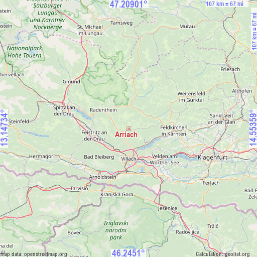
Arriach GPS coordinates[2]
46° 43' 45.156" North, 13° 51' 1.656" East
| Map corner | latitude | longitude |
|---|---|---|
| Upper-left | 47.20901°, | 13.14734° |
| Center: | 46.72921°, | 13.85046° |
| Lower-right: | 46.2451°, | 14.55359° |
| Map W x H: | 107.2×107.2 km | = 66.6×66.6mi |
| max Lat: | 48.98333° ⇑94.3% North |
| Arriach: | 46.72921° |
| min Lat: | ⇓5.7% South 46.48841° |
| min Long | Arriach | max Long |
| 9.57802° | 13.85046° | 17.1° |
| W 32%⇐ | ⇒68% E |
Elevation
Elevation of Arriach is 880 m = 2887 ft, and this is 374.5 m = 1229 ft above average elevation for this country.
| Max E: |
2140 m = 7021 ft | 10.1% |
| Arriach | 880 m 2887 ft | |
| Avg. | 505.5 m = 1658 ft | |
Min E: |
118 m = 387 ft | 89.9% |
See also: Austria elevation on elevation.city.
Geographical zone
Arriach is located in North temperate zone (between Tropic of Cancer and the Arctic Circle). Distance of this North polar circle is 2205.4 km =1370.4 mi to North.| Distance of | km | miles | from Arriach |
|---|---|---|---|
| North Pole | 4811.3 | 2989.6 | to North |
| Arctic Circle | 2205.4 | 1370.4 | to North |
| Tropic Cancer | 2589.9 | 1609.3 | to South |
| Equator | 5195.8 | 3228.5 | to South |


Nearby cities:
15 places around Arriach: (largest is in red/bold)
• Annenheim
8.7 km =5.4 mi,  153°
153°
• Bad Kleinkirchheim
11 km =6.8 mi,  330°
330°
• Bodensdorf
10.1 km =6.3 mi,  114°
114°
• Feld am See
9.4 km =5.8 mi,  303°
303°
• Gnesau
10 km =6.2 mi,  58°
58°
• Großvassach
11.3 km =7 mi,  180°
180°
• Kleinvassach
10.9 km =6.8 mi, 179°
• Puch
9.8 km =6.1 mi,  224°
224°
• Sankt Andrä
10 km =6.2 mi,  161°
161°
• Sankt Georgen
11.3 km =7 mi,  199°
199°
• Sankt Leonhard
11.6 km =7.2 mi, 176°
• Treffen
6.6 km =4.1 mi,  174°
174°
• Tschöran
10.1 km =6.3 mi,  123°
123°
• Untertweng
11 km =6.8 mi,  307°
307°
• Weissenstein
10.4 km =6.5 mi,  242°
242°
Sources, notices
• [Note1] Compared only with cities in Austria existing in our database
• [Src1] Map data: © OpenStreetMap contributors (CC-BY-SA)
• [Src2] Other city data from geonames.org with taken over terms of usage.
• [Src3] Geographical zone / Annual Mean Temperature by Robert A. Rohde @ Wikipedia
