Feld am See geodata
Feld am See (Carinthia) is a seat of a third-order administrative division; located in Austria in Europe/Vienna (GMT+2) time zone. With population of 667 people, there are 1943 cities with bigger population in this country. Compared to other cities in Austria, 92.5% of cities are located further ↑North; 70.4% of cities are located further →East and 82.6% of cities have lower elevation than Feld am See. Note1
Administrative division(s):
- Level 1: Carinthia
- Level 2: Politischer Bezirk Villach Land
- Level 3: Feld am See


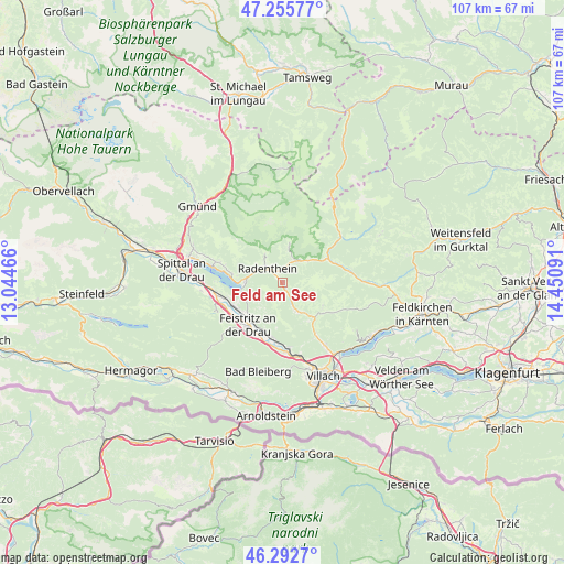
Feld am See GPS coordinates[2]
46° 46' 35.004" North, 13° 44' 52.008" East
| Map corner | latitude | longitude |
|---|---|---|
| Upper-left | 47.25577°, | 13.04466° |
| Center: | 46.77639°, | 13.74778° |
| Lower-right: | 46.2927°, | 14.45091° |
| Map W x H: | 107.1×107.1 km | = 66.5×66.5mi |
| max Lat: | 48.98333° ⇑92.5% North |
| Feld am See: | 46.77639° |
| min Lat: | ⇓7.5% South 46.48841° |
| min Long | Feld am See | max Long |
| 9.57802° | 13.74778° | 17.1° |
| W 29.6%⇐ | ⇒70.4% E |
Elevation
Elevation of Feld am See is 759 m = 2490 ft, and this is 253.5 m = 832 ft above average elevation for this country.
| Max E: |
2140 m = 7021 ft | 17.4% |
| Feld am See | 759 m 2490 ft | |
| Avg. | 505.5 m = 1658 ft | |
Min E: |
118 m = 387 ft | 82.6% |
See also: Austria elevation on elevation.city.
Geographical zone
Feld am See is located in North temperate zone (between Tropic of Cancer and the Arctic Circle). Distance of this North polar circle is 2200.1 km =1367.1 mi to North.| Distance of | km | miles | from Feld am See |
|---|---|---|---|
| North Pole | 4806 | 2986.3 | to North |
| Arctic Circle | 2200.1 | 1367.1 | to North |
| Tropic Cancer | 2595.1 | 1612.5 | to South |
| Equator | 5201 | 3231.8 | to South |


Nearby cities:
15 places around Feld am See: (largest is in red/bold)
• Arriach
9.4 km =5.8 mi,  123°
123°
• Bad Kleinkirchheim
5 km =3.1 mi,  29°
29°
• Döbriach
6.9 km =4.3 mi,  273°
273°
• Feistritz an der Drau
10.4 km =6.5 mi,  217°
217°
• Ferndorf
10.2 km =6.3 mi,  244°
244°
• Fresach
8 km =5 mi,  212°
212°
• Kaning
6.4 km =4 mi,  332°
332°
• Neu-Feffernitz
11.2 km =7 mi, 207°
• Nikelsdorf
11 km =6.8 mi, 224°
• Obermillstatt
11.9 km =7.4 mi,  290°
290°
• Paternion
11 km =6.8 mi,  230°
230°
• Puch
12.2 km =7.6 mi,  175°
175°
• Radenthein
3.8 km =2.4 mi,  314°
314°
• Untertweng
1.8 km =1.1 mi, 328°
• Weissenstein
10.2 km =6.3 mi,  187°
187°
Sources, notices
• [Note1] Compared only with cities in Austria existing in our database
• [Src1] Map data: © OpenStreetMap contributors (CC-BY-SA)
• [Src2] Other city data from geonames.org with taken over terms of usage.
• [Src3] Geographical zone / Annual Mean Temperature by Robert A. Rohde @ Wikipedia
