Ramsau am Dachstein geodata
Ramsau am Dachstein (Styria) is a populated place; located in Austria in Europe/Vienna (GMT+2) time zone. With population of 2,812 people, there are 411 cities with bigger population in this country. Compared to other cities in Austria, 58.2% of cities are located further ↑North; 72.3% of cities are located further →East and 97% of cities have lower elevation than Ramsau am Dachstein. Note1
Administrative division(s):
- Level 1: Styria
- Level 2: Politischer Bezirk Liezen
- Level 3: Gemeinde Ramsau am Dachstein


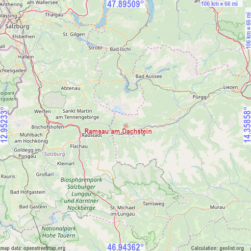
Ramsau am Dachstein GPS coordinates[2]
47° 25' 17.4" North, 13° 39' 19.62" East
| Map corner | latitude | longitude |
|---|---|---|
| Upper-left | 47.89509°, | 12.95233° |
| Center: | 47.4215°, | 13.65545° |
| Lower-right: | 46.94362°, | 14.35858° |
| Map W x H: | 105.8×105.8 km | = 65.7×65.7mi |
| max Lat: | 48.98333° ⇑58.2% North |
| Ramsau am Dachstein: | 47.4215° |
| min Lat: | ⇓41.8% South 46.48841° |
| min Long | Ramsau am Dachs | max Long |
| 9.57802° | 13.65545° | 17.1° |
| W 27.7%⇐ | ⇒72.3% E |
Elevation
Elevation of Ramsau am Dachstein is 1123 m = 3684 ft, and this is 617.5 m = 2026 ft above average elevation for this country.
| Max E: |
2140 m = 7021 ft | 3% |
| Ramsau am Dachstein | 1123 m 3684 ft | |
| Avg. | 505.5 m = 1658 ft | |
Min E: |
118 m = 387 ft | 97% |
See also: Austria elevation on elevation.city.
Geographical zone
Ramsau am Dachstein is located in North temperate zone (between Tropic of Cancer and the Arctic Circle). Distance of this North polar circle is 2128.4 km =1322.5 mi to North.| Distance of | km | miles | from Ramsau am Dachstein |
|---|---|---|---|
| North Pole | 4734.3 | 2941.8 | to North |
| Arctic Circle | 2128.4 | 1322.5 | to North |
| Tropic Cancer | 2666.9 | 1657.1 | to South |
| Equator | 5272.8 | 3276.4 | to South |


Nearby cities:
15 places around Ramsau am Dachstein: (largest is in red/bold)
• Aich
12.5 km =7.8 mi,  89°
89°
• Filzmoos
10.5 km =6.5 mi,  277°
277°
• Forstau
8.9 km =5.5 mi,  237°
237°
• Gössenberg
12.1 km =7.5 mi, 92°
• Haus
8.5 km =5.3 mi,  98°
98°
• Haus im Ennstal
8.5 km =5.3 mi, 98°
• Löbenau
13.6 km =8.5 mi,  251°
251°
• Neuberg
13.3 km =8.3 mi, 283°
• Obere Klaus
3.3 km =2.1 mi,  187°
187°
• Obertraun
15.3 km =9.5 mi,  8°
8°
• Pichl
6 km =3.7 mi,  224°
224°
• Rohrmoos
4.4 km =2.7 mi,  165°
165°
• Schladming
4 km =2.5 mi,  143°
143°
• Schwemmberg
13.3 km =8.3 mi,  258°
258°
• Weißenbach
9.3 km =5.8 mi, 88°
In other languages:
- In German: Ramsau
- In Russian: Пайтинг, Рамзау-ам-Дахштайн
- In Chinese: 达赫施泰因山麓拉姆绍
Sources, notices
• [Note1] Compared only with cities in Austria existing in our database
• [Src1] Map data: © OpenStreetMap contributors (CC-BY-SA)
• [Src2] Other city data from geonames.org with taken over terms of usage.
• [Src3] Geographical zone / Annual Mean Temperature by Robert A. Rohde @ Wikipedia
