Rohrmoos geodata
Rohrmoos (Styria) is a populated place; located in Austria in Europe/Vienna (GMT+2) time zone. With population of 942 people, there are 1365 cities with bigger population in this country. Compared to other cities in Austria, 60.4% of cities are located further ↑North; 71.9% of cities are located further →East and 93.7% of cities have lower elevation than Rohrmoos. Note1


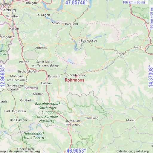
Rohrmoos GPS coordinates[2]
47° 23' 0.708" North, 13° 40' 11.82" East
| Map corner | latitude | longitude |
|---|---|---|
| Upper-left | 47.85746°, | 12.96683° |
| Center: | 47.38353°, | 13.66995° |
| Lower-right: | 46.9053°, | 14.37308° |
| Map W x H: | 105.9×105.9 km | = 65.8×65.8mi |
| max Lat: | 48.98333° ⇑60.4% North |
| Rohrmoos: | 47.38353° |
| min Lat: | ⇓39.6% South 46.48841° |
| min Long | Rohrmoos | max Long |
| 9.57802° | 13.66995° | 17.1° |
| W 28.1%⇐ | ⇒71.9% E |
Elevation
Elevation of Rohrmoos is 977 m = 3205 ft, and this is 471.5 m = 1547 ft above average elevation for this country.
| Max E: |
2140 m = 7021 ft | 6.3% |
| Rohrmoos | 977 m 3205 ft | |
| Avg. | 505.5 m = 1658 ft | |
Min E: |
118 m = 387 ft | 93.7% |
See also: Austria elevation on elevation.city.
Geographical zone
Rohrmoos is located in North temperate zone (between Tropic of Cancer and the Arctic Circle). Distance of this North polar circle is 2132.6 km =1325.1 mi to North.| Distance of | km | miles | from Rohrmoos |
|---|---|---|---|
| North Pole | 4738.5 | 2944.4 | to North |
| Arctic Circle | 2132.6 | 1325.1 | to North |
| Tropic Cancer | 2662.6 | 1654.5 | to South |
| Equator | 5268.6 | 3273.8 | to South |


Nearby cities:
15 places around Rohrmoos: (largest is in red/bold)
• Aich
12.2 km =7.6 mi,  69°
69°
• Filzmoos
12.8 km =8 mi,  295°
295°
• Forstau
8.6 km =5.3 mi,  266°
266°
• Gössenberg
11.6 km =7.2 mi, 71°
• Haus
7.9 km =4.9 mi, 68°
• Haus im Ennstal
7.9 km =4.9 mi, 67°
• Löbenau
14 km =8.7 mi, 269°
• Neuberg
15.9 km =9.9 mi, 297°
• Obere Klaus
1.8 km =1.1 mi, 302°
• Pichl
5.3 km =3.3 mi, 269°
• Ramsau am Dachstein
4.4 km =2.7 mi,  345°
345°
• Schladming
1.7 km =1.1 mi,  50°
50°
• Schwemmberg
14.2 km =8.8 mi,  276°
276°
• Untertauern
15.8 km =9.8 mi,  234°
234°
• Weißenbach
9.3 km =5.8 mi,  61°
61°
Sources, notices
• [Note1] Compared only with cities in Austria existing in our database
• [Src1] Map data: © OpenStreetMap contributors (CC-BY-SA)
• [Src2] Other city data from geonames.org with taken over terms of usage.
• [Src3] Geographical zone / Annual Mean Temperature by Robert A. Rohde @ Wikipedia
