Vorderweissenbach geodata
Vorderweissenbach (Upper Austria) is a populated place; located in Austria in Europe/Vienna (GMT+2) time zone. With population of 613 people, there are 2090 cities with bigger population in this country. Compared to other cities in Austria, 95.7% of cities are located further ↓South; 60.1% of cities are located further →East and 79.4% of cities have lower elevation than Vorderweissenbach. Note1
Administrative division(s):
- Level 1: Upper Austria
- Level 2: Politischer Bezirk Urfahr-Umgebung
- Level 3: Vorderweißenbach


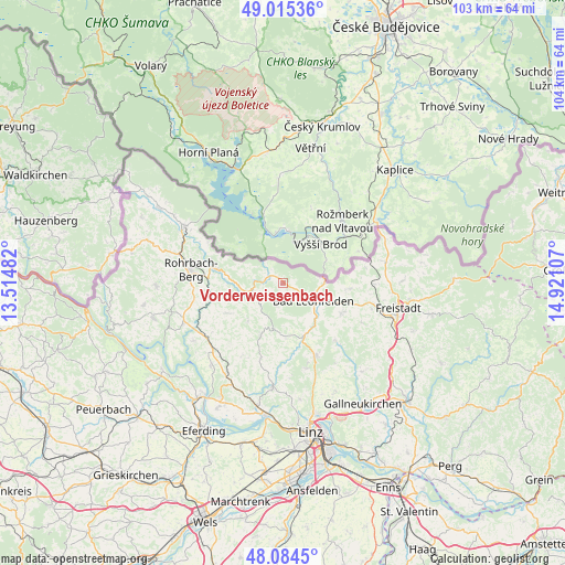
Vorderweissenbach GPS coordinates[2]
48° 33' 7.452" North, 14° 13' 4.584" East
| Map corner | latitude | longitude |
|---|---|---|
| Upper-left | 49.01536°, | 13.51482° |
| Center: | 48.55207°, | 14.21794° |
| Lower-right: | 48.0845°, | 14.92107° |
| Map W x H: | 103.5×103.5 km | = 64.3×64.3mi |
| max Lat: | 48.98333° ⇑4.3% North |
| Vorderweissenbach: | 48.55207° |
| min Lat: | ⇓95.7% South 46.48841° |
| min Long | Vorderweissenba | max Long |
| 9.57802° | 14.21794° | 17.1° |
| W 39.9%⇐ | ⇒60.1% E |
Elevation
Elevation of Vorderweissenbach is 705 m = 2313 ft, and this is 199.5 m = 655 ft above average elevation for this country.
| Max E: |
2140 m = 7021 ft | 20.6% |
| Vorderweissenbach | 705 m 2313 ft | |
| Avg. | 505.5 m = 1658 ft | |
Min E: |
118 m = 387 ft | 79.4% |
See also: Austria elevation on elevation.city.
Geographical zone
Vorderweissenbach is located in North temperate zone (between Tropic of Cancer and the Arctic Circle). Distance of this North polar circle is 2002.7 km =1244.4 mi to North.| Distance of | km | miles | from Vorderweissenbach |
|---|---|---|---|
| North Pole | 4608.6 | 2863.7 | to North |
| Arctic Circle | 2002.7 | 1244.4 | to North |
| Tropic Cancer | 2792.6 | 1735.2 | to South |
| Equator | 5398.5 | 3354.5 | to South |


Nearby cities:
15 places around Vorderweissenbach: (largest is in red/bold)
• Afiesl
7.4 km =4.6 mi,  296°
296°
• Ahorn
4.5 km =2.8 mi,  225°
225°
• Bad Leonfelden
6.6 km =4.1 mi,  121°
121°
• Burgfried
6.8 km =4.2 mi, 121°
• Haslach an der Mühl
13.4 km =8.3 mi,  281°
281°
• Hellmonsödt
14.5 km =9 mi,  155°
155°
• Oberneukirchen
9.8 km =6.1 mi,  177°
177°
• Reichenau im Mühlkreis
14.3 km =8.9 mi,  137°
137°
• Reichenthal
12.3 km =7.6 mi,  94°
94°
• Sankt Johann am Wimberg
9.6 km =6 mi,  222°
222°
• Sankt Peter am Wimberg
11.7 km =7.3 mi,  241°
241°
• Sankt Veit im Mühlkreis
10.2 km =6.3 mi,  203°
203°
• Schenkenfelden
11.9 km =7.4 mi, 117°
• Sonnberg im Mühlkreis
12.3 km =7.6 mi,  145°
145°
• Zwettl an der Rodl
10.4 km =6.5 mi, 157°
Sources, notices
• [Note1] Compared only with cities in Austria existing in our database
• [Src1] Map data: © OpenStreetMap contributors (CC-BY-SA)
• [Src2] Other city data from geonames.org with taken over terms of usage.
• [Src3] Geographical zone / Annual Mean Temperature by Robert A. Rohde @ Wikipedia
