Falkenstein geodata
Falkenstein (Styria) is a populated place; located in Austria in Europe/Vienna (GMT+2) time zone. With population of 508 people, there are 2481 cities with bigger population in this country. Compared to other cities in Austria, 56.5% of cities are located further ↑North; 71.3% of cities are located further ←West and 90% of cities have lower elevation than Falkenstein. Note1


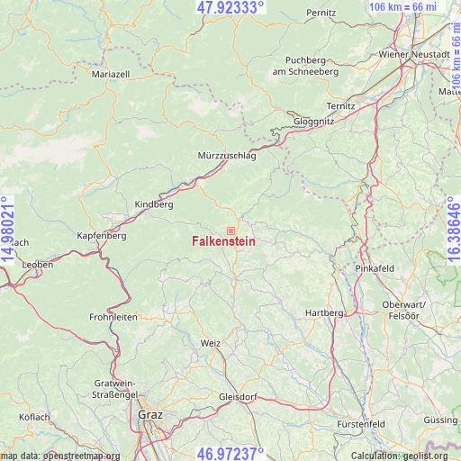
Falkenstein GPS coordinates[2]
47° 27' 0" North, 15° 40' 59.988" East
| Map corner | latitude | longitude |
|---|---|---|
| Upper-left | 47.92333°, | 14.98021° |
| Center: | 47.45°, | 15.68333° |
| Lower-right: | 46.97237°, | 16.38646° |
| Map W x H: | 105.7×105.7 km | = 65.7×65.7mi |
| max Lat: | 48.98333° ⇑56.5% North |
| Falkenstein: | 47.45° |
| min Lat: | ⇓43.5% South 46.48841° |
| min Long | Falkenstein | max Long |
| 9.57802° | 15.68333° | 17.1° |
| W 71.3%⇐ | ⇒28.7% E |
Elevation
Elevation of Falkenstein is 882 m = 2894 ft, and this is 376.5 m = 1235 ft above average elevation for this country.
| Max E: |
2140 m = 7021 ft | 10% |
| Falkenstein | 882 m 2894 ft | |
| Avg. | 505.5 m = 1658 ft | |
Min E: |
118 m = 387 ft | 90% |
See also: Austria elevation on elevation.city.
Geographical zone
Falkenstein is located in North temperate zone (between Tropic of Cancer and the Arctic Circle). Distance of this North polar circle is 2125.2 km =1320.5 mi to North.| Distance of | km | miles | from Falkenstein |
|---|---|---|---|
| North Pole | 4731.1 | 2939.8 | to North |
| Arctic Circle | 2125.2 | 1320.5 | to North |
| Tropic Cancer | 2670 | 1659.1 | to South |
| Equator | 5275.9 | 3278.3 | to South |


Nearby cities:
15 places around Falkenstein: (largest is in red/bold)
• Birkfeld
11.1 km =6.9 mi,  180°
180°
• Fischbach
2.7 km =1.7 mi,  251°
251°
• Gschaid bei Birkfeld
11 km =6.8 mi,  172°
172°
• Kirchenviertel
4.9 km =3 mi,  35°
35°
• Kirchenviertel
8.3 km =5.2 mi,  75°
75°
• Klaffenegg
9.5 km =5.9 mi, 37°
• Miesenbach bei Birkfeld
11.2 km =7 mi,  145°
145°
• Pittermann
8.4 km =5.2 mi,  116°
116°
• Ratten
4.5 km =2.8 mi,  34°
34°
• Rettenegg
11.3 km =7 mi, 40°
• Sankt Jakob im Walde
7.7 km =4.8 mi, 76°
• Sankt Kathrein am Hauenstein
4.5 km =2.8 mi,  10°
10°
• Sticklberg
11.5 km =7.1 mi, 38°
• Strallegg
5.3 km =3.3 mi,  143°
143°
• Waisenegg
6.2 km =3.9 mi, 179°
Sources, notices
• [Note1] Compared only with cities in Austria existing in our database
• [Src1] Map data: © OpenStreetMap contributors (CC-BY-SA)
• [Src2] Other city data from geonames.org with taken over terms of usage.
• [Src3] Geographical zone / Annual Mean Temperature by Robert A. Rohde @ Wikipedia
