Plankenwarth geodata
Plankenwarth (Styria) is a populated place; located in Austria in Europe/Vienna (GMT+2) time zone. With population of 528 people, there are 2399 cities with bigger population in this country. Compared to other cities in Austria, 79.5% of cities are located further ↑North; 60.4% of cities are located further ←West and 68% of cities have lower elevation than Plankenwarth. Note1
Administrative division(s):
- Level 1: Styria
- Level 2: Politischer Bezirk Graz-Umgebung
- Level 3: Sankt Oswald bei Plankenwarth


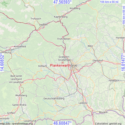
Plankenwarth GPS coordinates[2]
47° 5' 21.66" North, 15° 18' 41.904" East
| Map corner | latitude | longitude |
|---|---|---|
| Upper-left | 47.56593°, | 14.60852° |
| Center: | 47.08935°, | 15.31164° |
| Lower-right: | 46.60847°, | 16.01477° |
| Map W x H: | 106.5×106.5 km | = 66.2×66.2mi |
| max Lat: | 48.98333° ⇑79.5% North |
| Plankenwarth: | 47.08935° |
| min Lat: | ⇓20.5% South 46.48841° |
| min Long | Plankenwarth | max Long |
| 9.57802° | 15.31164° | 17.1° |
| W 60.4%⇐ | ⇒39.6% E |
Elevation
Elevation of Plankenwarth is 571 m = 1873 ft, and this is 65.5 m = 215 ft above average elevation for this country.
| Max E: |
2140 m = 7021 ft | 32% |
| Plankenwarth | 571 m 1873 ft | |
| Avg. | 505.5 m = 1658 ft | |
Min E: |
118 m = 387 ft | 68% |
See also: Austria elevation on elevation.city.
Geographical zone
Plankenwarth is located in North temperate zone (between Tropic of Cancer and the Arctic Circle). Distance of this North polar circle is 2165.3 km =1345.5 mi to North.| Distance of | km | miles | from Plankenwarth |
|---|---|---|---|
| North Pole | 4771.2 | 2964.7 | to North |
| Arctic Circle | 2165.3 | 1345.5 | to North |
| Tropic Cancer | 2629.9 | 1634.1 | to South |
| Equator | 5235.8 | 3253.4 | to South |


Nearby cities:
15 places around Plankenwarth: (largest is in red/bold)
• Eisbach
4.6 km =2.9 mi,  311°
311°
• Gratkorn
5.7 km =3.5 mi,  30°
30°
• Gratwein
3.1 km =1.9 mi,  7°
7°
• Hitzendorf
6.3 km =3.9 mi,  188°
188°
• Jaritzberg
4.7 km =2.9 mi,  261°
261°
• Judendorf
4.2 km =2.6 mi,  43°
43°
• Kirchenviertel
5.4 km =3.4 mi, 30°
• Rein
5.3 km =3.3 mi,  336°
336°
• Rohrbach
4.9 km =3 mi,  206°
206°
• Rötz
3.1 km =1.9 mi, 7°
• Sankt Bartholomä
5.6 km =3.5 mi,  225°
225°
• Sankt Oswald bei Plankenwarth
2.6 km =1.6 mi, 264°
• Steinberg
2.6 km =1.6 mi,  171°
171°
• Strassengel
3.3 km =2.1 mi, 28°
• Thal
4 km =2.5 mi,  111°
111°
Sources, notices
• [Note1] Compared only with cities in Austria existing in our database
• [Src1] Map data: © OpenStreetMap contributors (CC-BY-SA)
• [Src2] Other city data from geonames.org with taken over terms of usage.
• [Src3] Geographical zone / Annual Mean Temperature by Robert A. Rohde @ Wikipedia
