Illitsch geodata
Illitsch (Carinthia) is a seat of a third-order administrative division; located in Austria in Europe/Vienna (GMT+2) time zone. In our database, there are 2958 cities with bigger population. Compared to other cities in Austria, 99.8% of cities are located further ↑North; 67.5% of cities are located further →East and 91.2% of cities have lower elevation than Illitsch. Note1
Administrative division(s):
- Level 1: Carinthia
- Level 2: Politischer Bezirk Villach Land
- Level 3: Finkenstein am Faaker See


Illitsch GPS coordinates[2]
46° 32' 18.78" North, 13° 52' 0.516" East
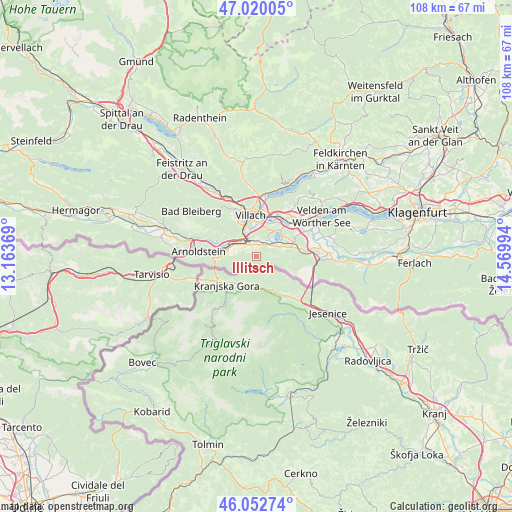
| Map corner | latitude | longitude |
|---|---|---|
| Upper-left | 47.02005°, | 13.16369° |
| Center: | 46.53855°, | 13.86681° |
| Lower-right: | 46.05274°, | 14.56994° |
| Map W x H: | 107.6×107.6 km | = 66.9×66.9mi |
| max Lat: | 48.98333° ⇑99.8% North |
| Illitsch: | 46.53855° |
| min Lat: | ⇓0.2% South 46.48841° |
| min Long | Illitsch | max Long |
| 9.57802° | 13.86681° | 17.1° |
| W 32.5%⇐ | ⇒67.5% E |
Elevation
Elevation of Illitsch is 906 m = 2972 ft, and this is 400.5 m = 1314 ft above average elevation for this country.
| Max E: |
2140 m = 7021 ft | 8.8% |
| Illitsch | 906 m 2972 ft | |
| Avg. | 505.5 m = 1658 ft | |
Min E: |
118 m = 387 ft | 91.2% |
See also: Austria elevation on elevation.city.
Geographical zone
Illitsch is located in North temperate zone (between Tropic of Cancer and the Arctic Circle). Distance of this North polar circle is 2226.6 km =1383.5 mi to North.| Distance of | km | miles | from Illitsch |
|---|---|---|---|
| North Pole | 4832.5 | 3002.8 | to North |
| Arctic Circle | 2226.6 | 1383.5 | to North |
| Tropic Cancer | 2568.7 | 1596.1 | to South |
| Equator | 5174.6 | 3215.3 | to South |


Nearby cities:
15 places around Illitsch: (largest is in red/bold)
• Auen
7 km =4.3 mi,  345°
345°
• Faak am See
4.6 km =2.9 mi,  44°
44°
• Finkenstein
2.6 km =1.6 mi,  6°
6°
• Finkenstein am Faaker See
6.9 km =4.3 mi,  49°
49°
• Fürnitz
4.6 km =2.9 mi,  304°
304°
• Latschach ober dem Faakersee
5.1 km =3.2 mi,  67°
67°
• Ledenitzen
7.9 km =4.9 mi, 66°
• Maria Gail
6.1 km =3.8 mi, 10°
• Riegersdorf
6.7 km =4.2 mi,  280°
280°
• Sankt Ulrich
8.7 km =5.4 mi,  25°
25°
• St. Agathen und Perau
7.6 km =4.7 mi, 353°
• Villach
8 km =5 mi, 353°
• Villach-Innere Stadt
8.4 km =5.2 mi, 349°
• Völkendorf
8.2 km =5.1 mi,  340°
340°
• Warmbad-Judendorf
7.8 km =4.8 mi,  334°
334°
Sources, notices
• [Note1] Compared only with cities in Austria existing in our database
• [Src1] Map data: © OpenStreetMap contributors (CC-BY-SA)
• [Src2] Other city data from geonames.org with taken over terms of usage.
• [Src3] Geographical zone / Annual Mean Temperature by Robert A. Rohde @ Wikipedia
