Riegersdorf geodata
Riegersdorf (Carinthia) is a populated place; located in Austria in Europe/Vienna (GMT+2) time zone. With population of 521 people, there are 2427 cities with bigger population in this country. Compared to other cities in Austria, 99.6% of cities are located further ↑North; 69.6% of cities are located further →East and 66.2% of cities have lower elevation than Riegersdorf. Note1
Administrative division(s):
- Level 1: Carinthia
- Level 2: Politischer Bezirk Villach Land
- Level 3: Arnoldstein


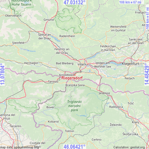
Riegersdorf GPS coordinates[2]
46° 32' 59.712" North, 13° 46' 52.176" East
| Map corner | latitude | longitude |
|---|---|---|
| Upper-left | 47.03132°, | 13.07804° |
| Center: | 46.54992°, | 13.78116° |
| Lower-right: | 46.06421°, | 14.48429° |
| Map W x H: | 107.5×107.5 km | = 66.8×66.8mi |
| max Lat: | 48.98333° ⇑99.6% North |
| Riegersdorf: | 46.54992° |
| min Lat: | ⇓0.4% South 46.48841° |
| min Long | Riegersdorf | max Long |
| 9.57802° | 13.78116° | 17.1° |
| W 30.4%⇐ | ⇒69.6% E |
Elevation
Elevation of Riegersdorf is 559 m = 1834 ft, and this is 53.5 m = 176 ft above average elevation for this country.
| Max E: |
2140 m = 7021 ft | 33.8% |
| Riegersdorf | 559 m 1834 ft | |
| Avg. | 505.5 m = 1658 ft | |
Min E: |
118 m = 387 ft | 66.2% |
See also: Austria elevation on elevation.city.
Geographical zone
Riegersdorf is located in North temperate zone (between Tropic of Cancer and the Arctic Circle). Distance of this North polar circle is 2225.3 km =1382.7 mi to North.| Distance of | km | miles | from Riegersdorf |
|---|---|---|---|
| North Pole | 4831.2 | 3002 | to North |
| Arctic Circle | 2225.3 | 1382.7 | to North |
| Tropic Cancer | 2569.9 | 1596.9 | to South |
| Equator | 5175.9 | 3216.2 | to South |


Nearby cities:
15 places around Riegersdorf: (largest is in red/bold)
• Arnoldstein
5.5 km =3.4 mi,  265°
265°
• Auen
7.3 km =4.5 mi,  40°
40°
• Finkenstein
7 km =4.3 mi,  79°
79°
• Fürnitz
3.1 km =1.9 mi,  64°
64°
• Gailitz
6 km =3.7 mi,  281°
281°
• Goritschach
7.2 km =4.5 mi,  17°
17°
• Illitsch
6.7 km =4.2 mi,  100°
100°
• Neufellach
8.4 km =5.2 mi, 17°
• Pöckau
2.8 km =1.7 mi, 270°
• Sankt Martin
8.3 km =5.2 mi,  25°
25°
• St. Agathen und Perau
8.5 km =5.3 mi, 42°
• Villach
8.8 km =5.5 mi, 40°
• Villach-Innere Stadt
8.6 km =5.3 mi, 35°
• Völkendorf
7.5 km =4.7 mi, 30°
• Warmbad-Judendorf
6.5 km =4 mi, 28°
Sources, notices
• [Note1] Compared only with cities in Austria existing in our database
• [Src1] Map data: © OpenStreetMap contributors (CC-BY-SA)
• [Src2] Other city data from geonames.org with taken over terms of usage.
• [Src3] Geographical zone / Annual Mean Temperature by Robert A. Rohde @ Wikipedia
