Altheim geodata
Altheim (Upper Austria) is a seat of a third-order administrative division; located in Austria in Europe/Vienna (GMT+2) time zone. With population of 4,195 people, there are 242 cities with bigger population in this country. Compared to other cities in Austria, 82.9% of cities are located further ↓South; 78.4% of cities are located further →East and 63.2% of cities have higher elevation than Altheim. Note1
Administrative division(s):
- Level 1: Upper Austria
- Level 2: Politischer Bezirk Braunau am Inn
- Level 3: Altheim


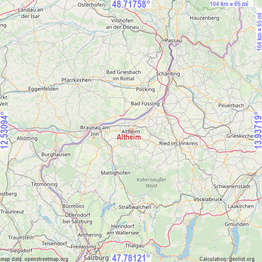
Altheim GPS coordinates[2]
48° 15' 5.544" North, 13° 14' 2.616" East
| Map corner | latitude | longitude |
|---|---|---|
| Upper-left | 48.71758°, | 12.53094° |
| Center: | 48.25154°, | 13.23406° |
| Lower-right: | 47.78121°, | 13.93719° |
| Map W x H: | 104.1×104.1 km | = 64.7×64.7mi |
| max Lat: | 48.98333° ⇑17.1% North |
| Altheim: | 48.25154° |
| min Lat: | ⇓82.9% South 46.48841° |
| min Long | Altheim | max Long |
| 9.57802° | 13.23406° | 17.1° |
| W 21.6%⇐ | ⇒78.4% E |
Elevation
Elevation of Altheim is 362 m = 1188 ft, and this is 143.5 m = 471 ft below average elevation for this country.
| Max E: |
2140 m = 7021 ft | 63.2% |
| Avg. | 505.5 m = 1658 ft | |
| Altheim | 362 m = 1188 ft | |
Min E: |
118 m = 387 ft | 36.8% |
See also: Austria elevation on elevation.city.
Geographical zone
Altheim is located in North temperate zone (between Tropic of Cancer and the Arctic Circle). Distance of this North polar circle is 2036.1 km =1265.2 mi to North.| Distance of | km | miles | from Altheim |
|---|---|---|---|
| North Pole | 4642 | 2884.4 | to North |
| Arctic Circle | 2036.1 | 1265.2 | to North |
| Tropic Cancer | 2759.1 | 1714.4 | to South |
| Equator | 5365.1 | 3333.7 | to South |


Nearby cities:
15 places around Altheim: (largest is in red/bold)
• Aspach
9 km =5.6 mi,  144°
144°
• Burgkirchen
11.2 km =7 mi,  242°
242°
• Geinberg
4.7 km =2.9 mi,  72°
72°
• Gurten
8.2 km =5.1 mi,  97°
97°
• Mauerkirchen
10 km =6.2 mi,  228°
228°
• Mining
6 km =3.7 mi,  297°
297°
• Obernberg am Inn
10.7 km =6.6 mi,  43°
43°
• Polling im Innkreis
4.1 km =2.5 mi,  123°
123°
• Sankt Georgen bei Obernberg am Inn
8.6 km =5.3 mi,  58°
58°
• Sankt Peter am Hart
10.2 km =6.3 mi,  270°
270°
• Treubach
6.4 km =4 mi,  195°
195°
• Weilbach
10.6 km =6.6 mi, 74°
• Weng im Innkreis
4.5 km =2.8 mi,  246°
246°
• Wildenau
8 km =5 mi,  129°
129°
• Wippenham
11.2 km =7 mi,  106°
106°
Sources, notices
• [Note1] Compared only with cities in Austria existing in our database
• [Src1] Map data: © OpenStreetMap contributors (CC-BY-SA)
• [Src2] Other city data from geonames.org with taken over terms of usage.
• [Src3] Geographical zone / Annual Mean Temperature by Robert A. Rohde @ Wikipedia
