Lingenau geodata
Lingenau (Vorarlberg) is a seat of a third-order administrative division; located in Austria in Europe/Vienna (GMT+2) time zone. With population of 1,466 people, there are 857 cities with bigger population in this country. Compared to other cities in Austria, 56.2% of cities are located further ↑North; 97.3% of cities are located further →East and 82.1% of cities have lower elevation than Lingenau. Note1
Administrative division(s):
- Level 1: Vorarlberg
- Level 2: Politischer Bezirk Bregenz
- Level 3: Lingenau


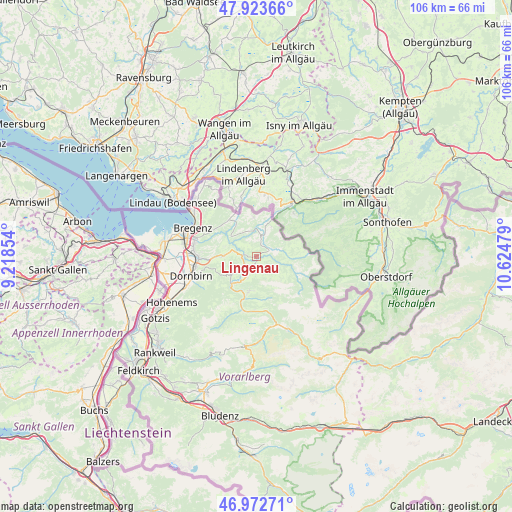
Lingenau GPS coordinates[2]
47° 27' 1.188" North, 9° 55' 17.976" East
| Map corner | latitude | longitude |
|---|---|---|
| Upper-left | 47.92366°, | 9.21854° |
| Center: | 47.45033°, | 9.92166° |
| Lower-right: | 46.97271°, | 10.62479° |
| Map W x H: | 105.7×105.7 km | = 65.7×65.7mi |
| max Lat: | 48.98333° ⇑56.2% North |
| Lingenau: | 47.45033° |
| min Lat: | ⇓43.8% South 46.48841° |
| min Long | Lingenau | max Long |
| 9.57802° | 9.92166° | 17.1° |
| W 2.7%⇐ | ⇒97.3% E |
Elevation
Elevation of Lingenau is 752 m = 2467 ft, and this is 246.5 m = 809 ft above average elevation for this country.
| Max E: |
2140 m = 7021 ft | 17.9% |
| Lingenau | 752 m 2467 ft | |
| Avg. | 505.5 m = 1658 ft | |
Min E: |
118 m = 387 ft | 82.1% |
See also: Austria elevation on elevation.city.
Geographical zone
Lingenau is located in North temperate zone (between Tropic of Cancer and the Arctic Circle). Distance of this North polar circle is 2125.2 km =1320.5 mi to North.| Distance of | km | miles | from Lingenau |
|---|---|---|---|
| North Pole | 4731.1 | 2939.8 | to North |
| Arctic Circle | 2125.2 | 1320.5 | to North |
| Tropic Cancer | 2670.1 | 1659.1 | to South |
| Equator | 5276 | 3278.4 | to South |


Nearby cities:
15 places around Lingenau: (largest is in red/bold)
• Alberschwende
6.8 km =4.2 mi,  269°
269°
• Andelsbuch
4.8 km =3 mi,  206°
206°
• Bezau
7.4 km =4.6 mi,  191°
191°
• Buch
8.5 km =5.3 mi,  297°
297°
• Doren
5.7 km =3.5 mi,  326°
326°
• Egg
2.8 km =1.7 mi,  220°
220°
• Großdorf
1.9 km =1.2 mi, 194°
• Hittisau
3 km =1.9 mi,  73°
73°
• Krumbach
3.8 km =2.4 mi,  16°
16°
• Langenegg
2.8 km =1.7 mi,  319°
319°
• Reuthe
9 km =5.6 mi, 192°
• Riefensberg
6.3 km =3.9 mi,  25°
25°
• Schwarzenberg
6.6 km =4.1 mi,  232°
232°
• Sibratsgfäll
9.1 km =5.7 mi,  106°
106°
• Sulzberg
8 km =5 mi,  355°
355°
Sources, notices
• [Note1] Compared only with cities in Austria existing in our database
• [Src1] Map data: © OpenStreetMap contributors (CC-BY-SA)
• [Src2] Other city data from geonames.org with taken over terms of usage.
• [Src3] Geographical zone / Annual Mean Temperature by Robert A. Rohde @ Wikipedia
