Egg geodata
Egg (Vorarlberg) is a seat of a third-order administrative division; located in Austria in Europe/Vienna (GMT+2) time zone. With population of 2,422 people, there are 495 cities with bigger population in this country. Compared to other cities in Austria, 57.6% of cities are located further ↑North; 97.6% of cities are located further →East and 63.8% of cities have lower elevation than Egg. Note1


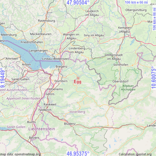
Egg GPS coordinates[2]
47° 25' 53.544" North, 9° 53' 51.432" East
| Map corner | latitude | longitude |
|---|---|---|
| Upper-left | 47.90504°, | 9.19449° |
| Center: | 47.43154°, | 9.89762° |
| Lower-right: | 46.95375°, | 10.60075° |
| Map W x H: | 105.8×105.8 km | = 65.7×65.7mi |
| max Lat: | 48.98333° ⇑57.6% North |
| Egg: | 47.43154° |
| min Lat: | ⇓42.4% South 46.48841° |
| min Long | Egg | max Long |
| 9.57802° | 9.89762° | 17.1° |
| W 2.4%⇐ | ⇒97.6% E |
Elevation
Elevation of Egg is 544 m = 1785 ft, and this is 38.5 m = 126 ft above average elevation for this country.
| Max E: |
2140 m = 7021 ft | 36.2% |
| Egg | 544 m 1785 ft | |
| Avg. | 505.5 m = 1658 ft | |
Min E: |
118 m = 387 ft | 63.8% |
See also: Austria elevation on elevation.city.
Geographical zone
Egg is located in North temperate zone (between Tropic of Cancer and the Arctic Circle). Distance of this North polar circle is 2127.3 km =1321.8 mi to North.| Distance of | km | miles | from Egg |
|---|---|---|---|
| North Pole | 4733.2 | 2941.1 | to North |
| Arctic Circle | 2127.3 | 1321.8 | to North |
| Tropic Cancer | 2668 | 1657.8 | to South |
| Equator | 5273.9 | 3277 | to South |


Nearby cities:
15 places around Egg: (largest is in red/bold)
• Alberschwende
5.4 km =3.4 mi,  292°
292°
• Andelsbuch
2.2 km =1.4 mi,  188°
188°
• Bezau
5.2 km =3.2 mi,  176°
176°
• Bizau
7.3 km =4.5 mi,  161°
161°
• Buch
8.3 km =5.2 mi,  316°
316°
• Doren
6.9 km =4.3 mi,  348°
348°
• Großdorf
1.3 km =0.8 mi,  80°
80°
• Hittisau
5.5 km =3.4 mi,  57°
57°
• Krumbach
6.4 km =4 mi,  26°
26°
• Langenegg
4.2 km =2.6 mi,  359°
359°
• Lingenau
2.8 km =1.7 mi,  40°
40°
• Mellau
9.1 km =5.7 mi, 187°
• Reuthe
6.7 km =4.2 mi, 181°
• Riefensberg
9 km =5.6 mi, 30°
• Schwarzenberg
4 km =2.5 mi,  240°
240°
Sources, notices
• [Note1] Compared only with cities in Austria existing in our database
• [Src1] Map data: © OpenStreetMap contributors (CC-BY-SA)
• [Src2] Other city data from geonames.org with taken over terms of usage.
• [Src3] Geographical zone / Annual Mean Temperature by Robert A. Rohde @ Wikipedia
