Alberschwende geodata
Alberschwende (Vorarlberg) is a populated place; located in Austria in Europe/Vienna (GMT+2) time zone. With population of 3,247 people, there are 341 cities with bigger population in this country. Compared to other cities in Austria, 56.3% of cities are located further ↑North; 98.1% of cities are located further →East and 80.1% of cities have lower elevation than Alberschwende. Note1
Administrative division(s):
- Level 1: Vorarlberg
- Level 2: Politischer Bezirk Bregenz
- Level 3: Alberschwende


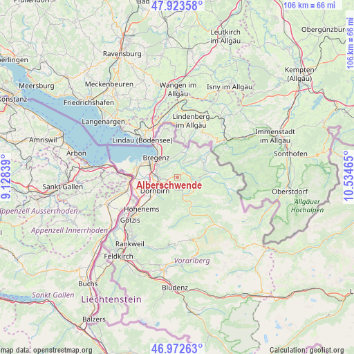
Alberschwende GPS coordinates[2]
47° 27' 0.9" North, 9° 49' 53.472" East
| Map corner | latitude | longitude |
|---|---|---|
| Upper-left | 47.92358°, | 9.12839° |
| Center: | 47.45025°, | 9.83152° |
| Lower-right: | 46.97263°, | 10.53465° |
| Map W x H: | 105.7×105.7 km | = 65.7×65.7mi |
| max Lat: | 48.98333° ⇑56.3% North |
| Alberschwende: | 47.45025° |
| min Lat: | ⇓43.7% South 46.48841° |
| min Long | Alberschwende | max Long |
| 9.57802° | 9.83152° | 17.1° |
| W 1.9%⇐ | ⇒98.1% E |
Elevation
Elevation of Alberschwende is 721 m = 2365 ft, and this is 215.5 m = 707 ft above average elevation for this country.
| Max E: |
2140 m = 7021 ft | 19.9% |
| Alberschwende | 721 m 2365 ft | |
| Avg. | 505.5 m = 1658 ft | |
Min E: |
118 m = 387 ft | 80.1% |
See also: Austria elevation on elevation.city.
Geographical zone
Alberschwende is located in North temperate zone (between Tropic of Cancer and the Arctic Circle). Distance of this North polar circle is 2125.2 km =1320.5 mi to North.| Distance of | km | miles | from Alberschwende |
|---|---|---|---|
| North Pole | 4731.1 | 2939.8 | to North |
| Arctic Circle | 2125.2 | 1320.5 | to North |
| Tropic Cancer | 2670.1 | 1659.1 | to South |
| Equator | 5276 | 3278.4 | to South |


Nearby cities:
15 places around Alberschwende: (largest is in red/bold)
• Andelsbuch
6.3 km =3.9 mi,  132°
132°
• Bildstein
4.9 km =3 mi,  269°
269°
• Buch
4 km =2.5 mi,  348°
348°
• Doren
6 km =3.7 mi,  37°
37°
• Dornbirn
7.8 km =4.8 mi,  239°
239°
• Egg
5.4 km =3.4 mi,  112°
112°
• Großdorf
6.6 km =4.1 mi, 106°
• Kennelbach
6.1 km =3.8 mi,  306°
306°
• Langen
7.5 km =4.7 mi, 351°
• Langenegg
5.4 km =3.4 mi,  66°
66°
• Lauterach
8.2 km =5.1 mi,  290°
290°
• Lingenau
6.8 km =4.2 mi,  89°
89°
• Schwarzach
5.2 km =3.2 mi, 268°
• Schwarzenberg
4.3 km =2.7 mi,  159°
159°
• Wolfurt
6.4 km =4 mi, 286°
Sources, notices
• [Note1] Compared only with cities in Austria existing in our database
• [Src1] Map data: © OpenStreetMap contributors (CC-BY-SA)
• [Src2] Other city data from geonames.org with taken over terms of usage.
• [Src3] Geographical zone / Annual Mean Temperature by Robert A. Rohde @ Wikipedia
