Donaustadt geodata
Donaustadt (Vienna) is a section of populated place; located in Austria in Europe/Vienna (GMT+2) time zone. With population of 187,007 people, there are 4 cities with bigger population in this country. Compared to other cities in Austria, 81.7% of cities are located further ↓South; 92.7% of cities are located further ←West and 98.5% of cities have higher elevation than Donaustadt. Note1


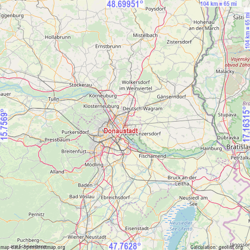
Donaustadt GPS coordinates[2]
48° 13' 59.88" North, 16° 27' 36.072" East
| Map corner | latitude | longitude |
|---|---|---|
| Upper-left | 48.69951°, | 15.7569° |
| Center: | 48.2333°, | 16.46002° |
| Lower-right: | 47.7628°, | 17.16315° |
| Map W x H: | 104.2×104.2 km | = 64.7×64.7mi |
| max Lat: | 48.98333° ⇑18.3% North |
| Donaustadt: | 48.2333° |
| min Lat: | ⇓81.7% South 46.48841° |
| min Long | Donaustadt | max Long |
| 9.57802° | 16.46002° | 17.1° |
| W 92.7%⇐ | ⇒7.3% E |
Elevation
Elevation of Donaustadt is 149 m = 489 ft, and this is 356.5 m = 1170 ft below average elevation for this country.
| Max E: |
2140 m = 7021 ft | 98.5% |
| Avg. | 505.5 m = 1658 ft | |
| Donaustadt | 149 m = 489 ft | |
Min E: |
118 m = 387 ft | 1.5% |
See also: Donaustadt elevation on elevation.city.
Geographical zone
Donaustadt is located in North temperate zone (between Tropic of Cancer and the Arctic Circle). Distance of this North polar circle is 2038.1 km =1266.4 mi to North.| Distance of | km | miles | from Donaustadt |
|---|---|---|---|
| North Pole | 4644 | 2885.6 | to North |
| Arctic Circle | 2038.1 | 1266.4 | to North |
| Tropic Cancer | 2757.1 | 1713.2 | to South |
| Equator | 5363 | 3332.4 | to South |


Nearby cities:
15 places around Donaustadt: (largest is in red/bold)
• Aderklaa
7.8 km =4.8 mi,  44°
44°
• Deutsch-Wagram
10.8 km =6.7 mi,  46°
46°
• Favoriten
9.9 km =6.2 mi,  215°
215°
• Floridsdorf
4.8 km =3 mi,  292°
292°
• Gerasdorf bei Wien
6.8 km =4.2 mi,  4°
4°
• Groß-Enzersdorf
7.5 km =4.7 mi,  116°
116°
• Innere Stadt
7.1 km =4.4 mi,  247°
247°
• Langenzersdorf
10.8 km =6.7 mi,  317°
317°
• Mannswörth
10.5 km =6.5 mi,  157°
157°
• Oberhausen
11.2 km =7 mi, 124°
• Raasdorf
7.9 km =4.9 mi,  79°
79°
• Schwechat
11.1 km =6.9 mi,  177°
177°
• Seyring
11.3 km =7 mi,  8°
8°
• Simmering
5.9 km =3.7 mi,  199°
199°
• Vienna
7.1 km =4.4 mi, 247°
Sources, notices
• [Note1] Compared only with cities in Austria existing in our database
• [Src1] Map data: © OpenStreetMap contributors (CC-BY-SA)
• [Src2] Other city data from geonames.org with taken over terms of usage.
• [Src3] Geographical zone / Annual Mean Temperature by Robert A. Rohde @ Wikipedia
