Williamstown geodata
Williamstown (South Australia) is a populated place; located in Australia in Australia/Adelaide (GMT+10.5) time zone. With population of 2,689 people, there are 2440 cities with bigger population in this country. Compared to other cities in Australia, 64.6% of cities are located further ↑North; 76.9% of cities are located further →East and 86.9% of cities have lower elevation than Williamstown. Note1


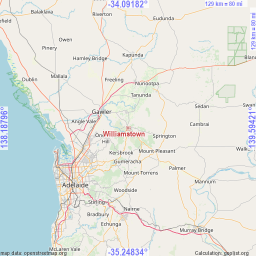
Williamstown GPS coordinates[2]
34° 40' 19.56" South, 138° 53' 27.888" East
| Map corner | latitude | longitude |
|---|---|---|
| Upper-left | -34.09182°, | 138.18796° |
| Center: | -34.6721°, | 138.89108° |
| Lower-right: | -35.24834°, | 139.59421° |
| Map W x H: | 128.6×128.6 km | = 79.9×79.9mi |
| max Lat: | -10.58257° ⇑64.6% North |
| Williamstown: | -34.6721° |
| min Lat: | ⇓35.4% South -43.31423° |
| min Long | Williamstown | max Long |
| 113.53327° | 138.89108° | 153.61246° |
| W 23.1%⇐ | ⇒76.9% E |
Elevation
Elevation of Williamstown is 285 m = 935 ft, and this is 163 m = 535 ft above average elevation for this country.
| Max E: |
1715 m = 5627 ft | 13.1% |
| Williamstown | 285 m 935 ft | |
| Avg. | 122 m = 400 ft | |
Min E: |
-2 m = -7 ft | 86.9% |
See also: Australia elevation on elevation.city.
Geographical zone
Williamstown is located in South temperate zone (between Tropic of Capricorn and the Antarctic Circle). Distance of this Southern Tropic circle is 1249.3 km =776.3 mi to North.| Distance of | km | miles | from Williamstown |
|---|---|---|---|
| Equator | 3855.2 | 2395.5 | to North |
| Tropic Capricorn | 1249.3 | 776.3 | to North |
| Antarctic Circle | 3546 | 2203.4 | to South |
| South Pole | 6151.9 | 3822.6 | to South |


Nearby cities:
15 places around Williamstown: (largest is in red/bold)
• Blakeview
16.6 km =10.3 mi,  268°
268°
• Cockatoo Valley
7.2 km =4.5 mi,  316°
316°
• Evanston
15.7 km =9.8 mi,  293°
293°
• Evanston Gardens
16.4 km =10.2 mi, 289°
• Evanston Park
14.8 km =9.2 mi, 291°
• Gawler
15.1 km =9.4 mi,  300°
300°
• Gawler East
14.3 km =8.9 mi, 304°
• Gawler South
15.2 km =9.4 mi, 298°
• Gawler West
16.3 km =10.1 mi, 297°
• Gawler city centre
15.9 km =9.9 mi, 302°
• Hewett
16.4 km =10.2 mi,  309°
309°
• Kersbrook
12.9 km =8 mi,  196°
196°
• Lyndoch
7.9 km =4.9 mi,  359°
359°
• One Tree Hill
11.8 km =7.3 mi,  254°
254°
• Willaston
16.7 km =10.4 mi, 304°
Sources, notices
• [Note1] Compared only with cities in Australia existing in our database
• [Src1] Map data: © OpenStreetMap contributors (CC-BY-SA)
• [Src2] Other city data from geonames.org with taken over terms of usage.
• [Src3] Geographical zone / Annual Mean Temperature by Robert A. Rohde @ Wikipedia
