Cockatoo Valley geodata
Cockatoo Valley (South Australia) is a populated place; located in Australia in Australia/Adelaide (GMT+10.5) time zone. With population of 681 people, there are 4359 cities with bigger population in this country. Compared to other cities in Australia, 64.3% of cities are located further ↑North; 77.2% of cities are located further →East and 79.3% of cities have lower elevation than Cockatoo Valley. Note1


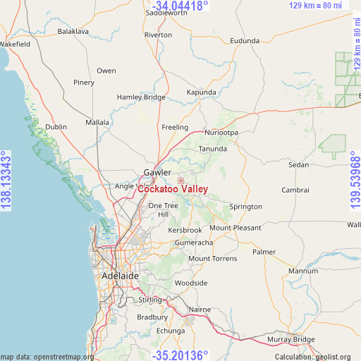
Cockatoo Valley GPS coordinates[2]
34° 37' 29.244" South, 138° 50' 11.58" East
| Map corner | latitude | longitude |
|---|---|---|
| Upper-left | -34.04418°, | 138.13343° |
| Center: | -34.62479°, | 138.83655° |
| Lower-right: | -35.20136°, | 139.53968° |
| Map W x H: | 128.7×128.7 km | = 80×80mi |
| max Lat: | -10.58257° ⇑64.3% North |
| Cockatoo Valley: | -34.62479° |
| min Lat: | ⇓35.7% South -43.31423° |
| min Long | Cockatoo Valley | max Long |
| 113.53327° | 138.83655° | 153.61246° |
| W 22.8%⇐ | ⇒77.2% E |
Elevation
Elevation of Cockatoo Valley is 171 m = 561 ft, and this is 49 m = 161 ft above average elevation for this country.
| Max E: |
1715 m = 5627 ft | 20.7% |
| Cockatoo Valley | 171 m 561 ft | |
| Avg. | 122 m = 400 ft | |
Min E: |
-2 m = -7 ft | 79.3% |
See also: Australia elevation on elevation.city.
Geographical zone
Cockatoo Valley is located in South temperate zone (between Tropic of Capricorn and the Antarctic Circle). Distance of this Southern Tropic circle is 1244 km =773 mi to North.| Distance of | km | miles | from Cockatoo Valley |
|---|---|---|---|
| Equator | 3849.9 | 2392.2 | to North |
| Tropic Capricorn | 1244 | 773 | to North |
| Antarctic Circle | 3551.3 | 2206.7 | to South |
| South Pole | 6157.1 | 3825.8 | to South |


Nearby cities:
15 places around Cockatoo Valley: (largest is in red/bold)
• Evanston
9.5 km =5.9 mi,  275°
275°
• Evanston Gardens
10.5 km =6.5 mi,  270°
270°
• Evanston Park
8.7 km =5.4 mi, 271°
• Gawler
8.4 km =5.2 mi,  287°
287°
• Gawler East
7.3 km =4.5 mi, 293°
• Gawler South
8.7 km =5.4 mi, 283°
• Gawler West
9.8 km =6.1 mi, 283°
• Gawler city centre
9 km =5.6 mi, 290°
• Hewett
9.3 km =5.8 mi,  304°
304°
• Kudla
12.5 km =7.8 mi,  261°
261°
• Lyndoch
5.6 km =3.5 mi,  62°
62°
• One Tree Hill
10.5 km =6.5 mi,  217°
217°
• Roseworthy
12.8 km =8 mi,  321°
321°
• Willaston
9.7 km =6 mi, 296°
• Williamstown
7.2 km =4.5 mi,  136°
136°
Sources, notices
• [Note1] Compared only with cities in Australia existing in our database
• [Src1] Map data: © OpenStreetMap contributors (CC-BY-SA)
• [Src2] Other city data from geonames.org with taken over terms of usage.
• [Src3] Geographical zone / Annual Mean Temperature by Robert A. Rohde @ Wikipedia
