Keysbrook geodata
Keysbrook (Western Australia) is a section of populated place; located in Australia in Australia/Perth (GMT+8) time zone. With population of 617 people, there are 4522 cities with bigger population in this country. Compared to other cities in Australia, 61.7% of cities are located further ↓South; 93% of cities are located further →East and 50.2% of cities have lower elevation than Keysbrook. Note1


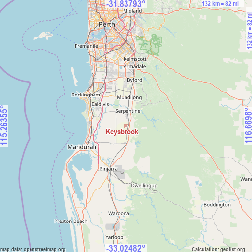
Keysbrook GPS coordinates[2]
32° 25' 59.988" South, 115° 58' 0.012" East
| Map corner | latitude | longitude |
|---|---|---|
| Upper-left | -31.83793°, | 115.26355° |
| Center: | -32.43333°, | 115.96667° |
| Lower-right: | -33.02482°, | 116.6698° |
| Map W x H: | 132×132 km | = 82×82mi |
| max Lat: | -10.58257° ⇑38.3% North |
| Keysbrook: | -32.43333° |
| min Lat: | ⇓61.7% South -43.31423° |
| min Long | Keysbrook | max Long |
| 113.53327° | 115.96667° | 153.61246° |
| W 7%⇐ | ⇒93% E |
Elevation
Elevation of Keysbrook is 46 m = 151 ft, and this is 76 m = 249 ft below average elevation for this country.
| Max E: |
1715 m = 5627 ft | 49.8% |
| Avg. | 122 m = 400 ft | |
| Keysbrook | 46 m = 151 ft | |
Min E: |
-2 m = -7 ft | 50.2% |
See also: Australia elevation on elevation.city.
Geographical zone
Keysbrook is located in South temperate zone (between Tropic of Capricorn and the Antarctic Circle). Distance of this Southern Tropic circle is 1000.3 km =621.6 mi to North.| Distance of | km | miles | from Keysbrook |
|---|---|---|---|
| Equator | 3606.2 | 2240.8 | to North |
| Tropic Capricorn | 1000.3 | 621.6 | to North |
| Antarctic Circle | 3794.9 | 2358 | to South |
| South Pole | 6400.8 | 3977.3 | to South |


Nearby cities:
15 places around Keysbrook: (largest is in red/bold)
• Baldivis
17.3 km =10.7 mi,  312°
312°
• Cardup
19.6 km =12.2 mi,  5°
5°
• Golden Bay
19.3 km =12 mi,  272°
272°
• Jarrahdale
13.9 km =8.6 mi,  38°
38°
• Karnup
16.4 km =10.2 mi,  275°
275°
• Lakelands
18.7 km =11.6 mi,  256°
256°
• Madora Bay
20.5 km =12.7 mi, 258°
• Meadow Springs
21.2 km =13.2 mi,  250°
250°
• Mundijong
15.8 km =9.8 mi, 6°
• North Dandalup
9.3 km =5.8 mi,  176°
176°
• Parklands
19.4 km =12.1 mi, 249°
• Ravenswood
20.9 km =13 mi,  217°
217°
• Secret Harbour
19.8 km =12.3 mi, 278°
• Serpentine
8.2 km =5.1 mi, 6°
• Singleton
19.7 km =12.2 mi, 266°
Sources, notices
• [Note1] Compared only with cities in Australia existing in our database
• [Src1] Map data: © OpenStreetMap contributors (CC-BY-SA)
• [Src2] Other city data from geonames.org with taken over terms of usage.
• [Src3] Geographical zone / Annual Mean Temperature by Robert A. Rohde @ Wikipedia
