Callington geodata
Callington (South Australia) is a populated place; located in Australia in Australia/Adelaide (GMT+10.5) time zone. With population of 589 people, there are 4599 cities with bigger population in this country. Compared to other cities in Australia, 73.2% of cities are located further ↑North; 76.7% of cities are located further →East and 68.4% of cities have lower elevation than Callington. Note1


Callington GPS coordinates[2]
35° 7' 11.172" South, 139° 2' 29.04" East
| Map corner | latitude | longitude |
|---|---|---|
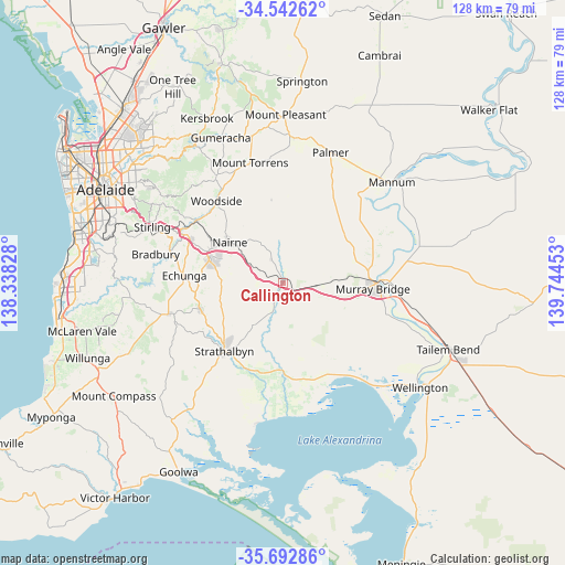
| Upper-left | -34.54262°, | 138.33828° |
| Center: | -35.11977°, | 139.0414° |
| Lower-right: | -35.69286°, | 139.74453° |
| Map W x H: | 127.9×127.9 km | = 79.5×79.5mi |
| max Lat: | -10.58257° ⇑73.2% North |
| Callington: | -35.11977° |
| min Lat: | ⇓26.8% South -43.31423° |
| min Long | Callington | max Long |
| 113.53327° | 139.0414° | 153.61246° |
| W 23.3%⇐ | ⇒76.7% E |
Elevation
Elevation of Callington is 94 m = 308 ft, and this is 28 m = 92 ft below average elevation for this country.
| Max E: |
1715 m = 5627 ft | 31.6% |
| Avg. | 122 m = 400 ft | |
| Callington | 94 m = 308 ft | |
Min E: |
-2 m = -7 ft | 68.4% |
See also: Australia elevation on elevation.city.
Geographical zone
Callington is located in South temperate zone (between Tropic of Capricorn and the Antarctic Circle). Distance of this Southern Tropic circle is 1299 km =807.2 mi to North.| Distance of | km | miles | from Callington |
|---|---|---|---|
| Equator | 3905 | 2426.5 | to North |
| Tropic Capricorn | 1299 | 807.2 | to North |
| Antarctic Circle | 3496.2 | 2172.4 | to South |
| South Pole | 6102.1 | 3791.7 | to South |


Nearby cities:
15 places around Callington: (largest is in red/bold)
• Balhannah
24.3 km =15.1 mi,  306°
306°
• Charleston
26 km =16.2 mi,  330°
330°
• Echunga
22.4 km =13.9 mi,  274°
274°
• Hahndorf
23.6 km =14.7 mi,  295°
295°
• Kanmantoo
6.1 km =3.8 mi, 334°
• Little Hampton
18.3 km =11.4 mi, 298°
• Macclesfield
19.6 km =12.2 mi,  252°
252°
• Meadows
26.2 km =16.3 mi,  255°
255°
• Mount Barker
17 km =10.6 mi,  290°
290°
• Murray Bridge
21.1 km =13.1 mi,  90°
90°
• Nairne
15.2 km =9.4 mi, 308°
• Oakbank
23.4 km =14.5 mi, 310°
• Riverglades
23.8 km =14.8 mi,  84°
84°
• Strathalbyn
20.6 km =12.8 mi,  220°
220°
• Woodside
23.6 km =14.7 mi,  321°
321°
Sources, notices
• [Note1] Compared only with cities in Australia existing in our database
• [Src1] Map data: © OpenStreetMap contributors (CC-BY-SA)
• [Src2] Other city data from geonames.org with taken over terms of usage.
• [Src3] Geographical zone / Annual Mean Temperature by Robert A. Rohde @ Wikipedia
