Bicton geodata
Bicton (Western Australia) is a section of populated place; located in Australia in Australia/Perth (GMT+8) time zone. With population of 6,422 people, there are 1097 cities with bigger population in this country. Compared to other cities in Australia, 64.7% of cities are located further ↓South; 96.4% of cities are located further →East and 64.8% of cities have higher elevation than Bicton. Note1


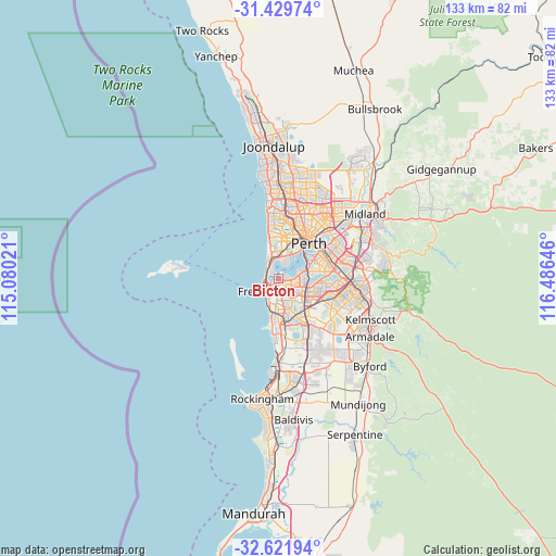
Bicton GPS coordinates[2]
32° 1' 40.008" South, 115° 46' 59.988" East
| Map corner | latitude | longitude |
|---|---|---|
| Upper-left | -31.42974°, | 115.08021° |
| Center: | -32.02778°, | 115.78333° |
| Lower-right: | -32.62194°, | 116.48646° |
| Map W x H: | 132.6×132.6 km | = 82.4×82.4mi |
| max Lat: | -10.58257° ⇑35.3% North |
| Bicton: | -32.02778° |
| min Lat: | ⇓64.7% South -43.31423° |
| min Long | Bicton | max Long |
| 113.53327° | 115.78333° | 153.61246° |
| W 3.6%⇐ | ⇒96.4% E |
Elevation
Elevation of Bicton is 27 m = 89 ft, and this is 95 m = 312 ft below average elevation for this country.
| Max E: |
1715 m = 5627 ft | 64.8% |
| Avg. | 122 m = 400 ft | |
| Bicton | 27 m = 89 ft | |
Min E: |
-2 m = -7 ft | 35.2% |
See also: Australia elevation on elevation.city.
Geographical zone
Bicton is located in South temperate zone (between Tropic of Capricorn and the Antarctic Circle). Distance of this Southern Tropic circle is 955.2 km =593.5 mi to North.| Distance of | km | miles | from Bicton |
|---|---|---|---|
| Equator | 3561.2 | 2212.8 | to North |
| Tropic Capricorn | 955.2 | 593.5 | to North |
| Antarctic Circle | 3840 | 2386.1 | to South |
| South Pole | 6445.9 | 4005.3 | to South |


Nearby cities:
15 places around Bicton: (largest is in red/bold)
• Alfred Cove
2.8 km =1.7 mi,  102°
102°
• Attadale
1.8 km =1.1 mi,  79°
79°
• Beaconsfield
4.8 km =3 mi,  202°
202°
• Cottesloe
4.4 km =2.7 mi,  327°
327°
• Dalkeith
3.9 km =2.4 mi,  23°
23°
• East Fremantle
1.9 km =1.2 mi,  231°
231°
• Hilton
3.8 km =2.4 mi,  184°
184°
• Melville
2.2 km =1.4 mi,  129°
129°
• Mosman Park
3.1 km =1.9 mi,  323°
323°
• Myaree
3.5 km =2.2 mi,  112°
112°
• North Fremantle
3.2 km =2 mi,  258°
258°
• Palmyra
1.9 km =1.2 mi,  172°
172°
• Peppermint Grove
3.5 km =2.2 mi,  336°
336°
• White Gum Valley
3.8 km =2.4 mi, 198°
• Willagee
3.4 km =2.1 mi,  142°
142°
Sources, notices
• [Note1] Compared only with cities in Australia existing in our database
• [Src1] Map data: © OpenStreetMap contributors (CC-BY-SA)
• [Src2] Other city data from geonames.org with taken over terms of usage.
• [Src3] Geographical zone / Annual Mean Temperature by Robert A. Rohde @ Wikipedia
