Palmyra geodata
Palmyra (Western Australia) is a section of populated place; located in Australia in Australia/Perth (GMT+8) time zone. With population of 6,737 people, there are 1020 cities with bigger population in this country. Compared to other cities in Australia, 64.3% of cities are located further ↓South; 96.4% of cities are located further →East and 57.6% of cities have higher elevation than Palmyra. Note1


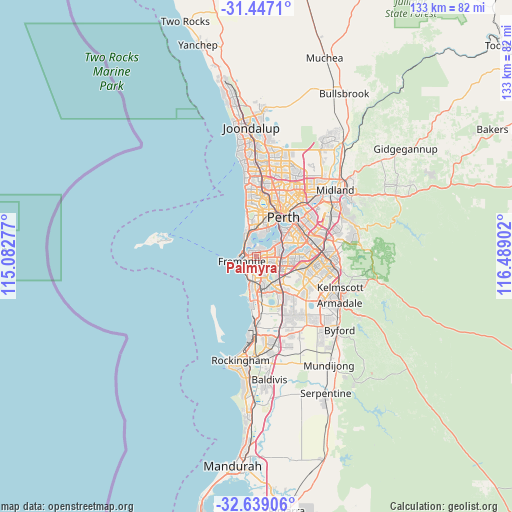
Palmyra GPS coordinates[2]
32° 2' 42.072" South, 115° 47' 9.204" East
| Map corner | latitude | longitude |
|---|---|---|
| Upper-left | -31.4471°, | 115.08277° |
| Center: | -32.04502°, | 115.78589° |
| Lower-right: | -32.63906°, | 116.48902° |
| Map W x H: | 132.5×132.5 km | = 82.3×82.3mi |
| max Lat: | -10.58257° ⇑35.7% North |
| Palmyra: | -32.04502° |
| min Lat: | ⇓64.3% South -43.31423° |
| min Long | Palmyra | max Long |
| 113.53327° | 115.78589° | 153.61246° |
| W 3.6%⇐ | ⇒96.4% E |
Elevation
Elevation of Palmyra is 35 m = 115 ft, and this is 87 m = 285 ft below average elevation for this country.
| Max E: |
1715 m = 5627 ft | 57.6% |
| Avg. | 122 m = 400 ft | |
| Palmyra | 35 m = 115 ft | |
Min E: |
-2 m = -7 ft | 42.4% |
See also: Australia elevation on elevation.city.
Geographical zone
Palmyra is located in South temperate zone (between Tropic of Capricorn and the Antarctic Circle). Distance of this Southern Tropic circle is 957.2 km =594.8 mi to North.| Distance of | km | miles | from Palmyra |
|---|---|---|---|
| Equator | 3563.1 | 2214 | to North |
| Tropic Capricorn | 957.2 | 594.8 | to North |
| Antarctic Circle | 3838.1 | 2384.9 | to South |
| South Pole | 6444 | 4004.1 | to South |


Nearby cities:
15 places around Palmyra: (largest is in red/bold)
• Alfred Cove
2.8 km =1.7 mi,  62°
62°
• Attadale
2.7 km =1.7 mi,  34°
34°
• Beaconsfield
3.2 km =2 mi,  219°
219°
• Bicton
1.9 km =1.2 mi,  352°
352°
• East Fremantle
1.9 km =1.2 mi,  293°
293°
• Fremantle
4 km =2.5 mi,  251°
251°
• Hilton
2 km =1.2 mi,  195°
195°
• Kardinya
3.6 km =2.2 mi,  130°
130°
• Melville
1.5 km =0.9 mi,  70°
70°
• Myaree
3 km =1.9 mi,  79°
79°
• North Fremantle
3.6 km =2.2 mi, 291°
• Samson
3 km =1.9 mi,  158°
158°
• South Fremantle
4 km =2.5 mi,  227°
227°
• White Gum Valley
2.2 km =1.4 mi, 220°
• Willagee
2 km =1.2 mi,  112°
112°
Sources, notices
• [Note1] Compared only with cities in Australia existing in our database
• [Src1] Map data: © OpenStreetMap contributors (CC-BY-SA)
• [Src2] Other city data from geonames.org with taken over terms of usage.
• [Src3] Geographical zone / Annual Mean Temperature by Robert A. Rohde @ Wikipedia
