Attadale geodata
Attadale (Western Australia) is a section of populated place; located in Australia in Australia/Perth (GMT+8) time zone. With population of 6,196 people, there are 1151 cities with bigger population in this country. Compared to other cities in Australia, 64.7% of cities are located further ↓South; 96% of cities are located further →East and 77.5% of cities have higher elevation than Attadale. Note1


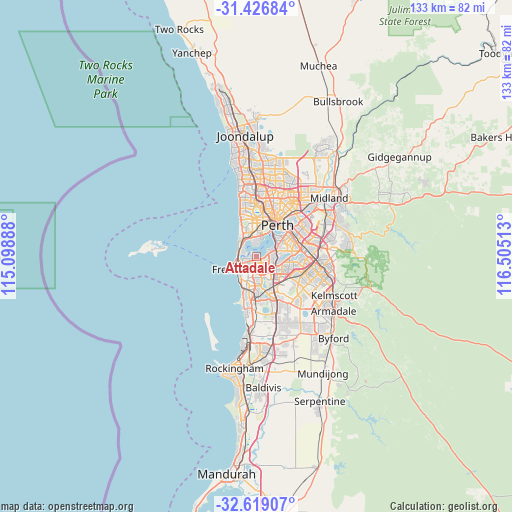
Attadale GPS coordinates[2]
32° 1' 29.604" South, 115° 48' 7.2" East
| Map corner | latitude | longitude |
|---|---|---|
| Upper-left | -31.42684°, | 115.09888° |
| Center: | -32.02489°, | 115.802° |
| Lower-right: | -32.61907°, | 116.50513° |
| Map W x H: | 132.6×132.6 km | = 82.4×82.4mi |
| max Lat: | -10.58257° ⇑35.3% North |
| Attadale: | -32.02489° |
| min Lat: | ⇓64.7% South -43.31423° |
| min Long | Attadale | max Long |
| 113.53327° | 115.802° | 153.61246° |
| W 4%⇐ | ⇒96% E |
Elevation
Elevation of Attadale is 17 m = 56 ft, and this is 105 m = 344 ft below average elevation for this country.
| Max E: |
1715 m = 5627 ft | 77.5% |
| Avg. | 122 m = 400 ft | |
| Attadale | 17 m = 56 ft | |
Min E: |
-2 m = -7 ft | 22.5% |
See also: Australia elevation on elevation.city.
Geographical zone
Attadale is located in South temperate zone (between Tropic of Capricorn and the Antarctic Circle). Distance of this Southern Tropic circle is 954.9 km =593.3 mi to North.| Distance of | km | miles | from Attadale |
|---|---|---|---|
| Equator | 3560.8 | 2212.6 | to North |
| Tropic Capricorn | 954.9 | 593.3 | to North |
| Antarctic Circle | 3840.3 | 2386.3 | to South |
| South Pole | 6446.2 | 4005.5 | to South |


Nearby cities:
15 places around Attadale: (largest is in red/bold)
• Alfred Cove
1.4 km =0.9 mi,  132°
132°
• Applecross
3.1 km =1.9 mi,  72°
72°
• Ardross
3.2 km =2 mi,  94°
94°
• Bicton
1.8 km =1.1 mi,  259°
259°
• Booragoon
3.4 km =2.1 mi,  118°
118°
• Dalkeith
3.3 km =2.1 mi,  356°
356°
• East Fremantle
3.6 km =2.2 mi,  245°
245°
• Hilton
4.6 km =2.9 mi,  206°
206°
• Melville
1.7 km =1.1 mi,  182°
182°
• Mosman Park
4.2 km =2.6 mi,  301°
301°
• Myaree
2.2 km =1.4 mi,  138°
138°
• Palmyra
2.7 km =1.7 mi, 214°
• Peppermint Grove
4.3 km =2.7 mi,  312°
312°
• Willagee
3 km =1.9 mi,  174°
174°
• Winthrop
4 km =2.5 mi, 139°
Sources, notices
• [Note1] Compared only with cities in Australia existing in our database
• [Src1] Map data: © OpenStreetMap contributors (CC-BY-SA)
• [Src2] Other city data from geonames.org with taken over terms of usage.
• [Src3] Geographical zone / Annual Mean Temperature by Robert A. Rohde @ Wikipedia
