Yinnar geodata
Yinnar (Victoria) is a populated place; located in Australia in Australia/Melbourne (GMT+11) time zone. With population of 863 people, there are 4035 cities with bigger population in this country. Compared to other cities in Australia, 94.8% of cities are located further ↑North; 56% of cities are located further →East and 64% of cities have lower elevation than Yinnar. Note1


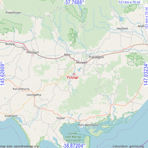
Yinnar GPS coordinates[2]
38° 19' 21.072" South, 146° 19' 45.156" East
| Map corner | latitude | longitude |
|---|---|---|
| Upper-left | -37.7688°, | 145.62609° |
| Center: | -38.32252°, | 146.32921° |
| Lower-right: | -38.87204°, | 147.03234° |
| Map W x H: | 122.7×122.7 km | = 76.2×76.2mi |
| max Lat: | -10.58257° ⇑94.8% North |
| Yinnar: | -38.32252° |
| min Lat: | ⇓5.2% South -43.31423° |
| min Long | Yinnar | max Long |
| 113.53327° | 146.32921° | 153.61246° |
| W 44%⇐ | ⇒56% E |
Elevation
Elevation of Yinnar is 76 m = 249 ft, and this is 46 m = 151 ft below average elevation for this country.
| Max E: |
1715 m = 5627 ft | 36% |
| Avg. | 122 m = 400 ft | |
| Yinnar | 76 m = 249 ft | |
Min E: |
-2 m = -7 ft | 64% |
See also: Australia elevation on elevation.city.
Geographical zone
Yinnar is located in South temperate zone (between Tropic of Capricorn and the Antarctic Circle). Distance of this Southern Tropic circle is 1655.1 km =1028.4 mi to North.| Distance of | km | miles | from Yinnar |
|---|---|---|---|
| Equator | 4261.1 | 2647.7 | to North |
| Tropic Capricorn | 1655.1 | 1028.4 | to North |
| Antarctic Circle | 3140.1 | 1951.2 | to South |
| South Pole | 5746 | 3570.4 | to South |


Nearby cities:
15 places around Yinnar: (largest is in red/bold)
• Boolarra
7.9 km =4.9 mi,  216°
216°
• Churchill
7.5 km =4.7 mi,  77°
77°
• Hazelwood North
14.7 km =9.1 mi,  65°
65°
• Jeeralang Junction
7.8 km =4.8 mi,  111°
111°
• Mirboo North
17 km =10.6 mi,  239°
239°
• Moe
17.1 km =10.6 mi,  339°
339°
• Moe South
13.9 km =8.6 mi,  331°
331°
• Morwell
11.3 km =7 mi,  30°
30°
• Newborough
17.1 km =10.6 mi,  349°
349°
• Trafalgar
19.9 km =12.4 mi,  309°
309°
• Traralgon
23.3 km =14.5 mi,  52°
52°
• Traralgon South
19.3 km =12 mi, 79°
• Tyers
23.4 km =14.5 mi, 34°
• Yallourn North
18.3 km =11.4 mi,  9°
9°
• Yinnar South
8.2 km =5.1 mi,  145°
145°
Sources, notices
• [Note1] Compared only with cities in Australia existing in our database
• [Src1] Map data: © OpenStreetMap contributors (CC-BY-SA)
• [Src2] Other city data from geonames.org with taken over terms of usage.
• [Src3] Geographical zone / Annual Mean Temperature by Robert A. Rohde @ Wikipedia
