Wentworth Falls geodata
Wentworth Falls (New South Wales) is a section of populated place; located in Australia in Australia/Sydney (GMT+11) time zone. With population of 5,928 people, there are 1219 cities with bigger population in this country. Compared to other cities in Australia, 51% of cities are located further ↓South; 58.1% of cities are located further ←West and 99.2% of cities have lower elevation than Wentworth Falls. Note1


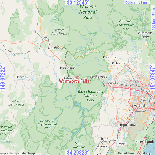
Wentworth Falls GPS coordinates[2]
33° 42' 37.188" South, 150° 22' 31.224" East
| Map corner | latitude | longitude |
|---|---|---|
| Upper-left | -33.12345°, | 149.67222° |
| Center: | -33.71033°, | 150.37534° |
| Lower-right: | -34.29323°, | 151.07847° |
| Map W x H: | 130.1×130.1 km | = 80.8×80.8mi |
| max Lat: | -10.58257° ⇑49% North |
| Wentworth Falls: | -33.71033° |
| min Lat: | ⇓51% South -43.31423° |
| min Long | Wentworth Falls | max Long |
| 113.53327° | 150.37534° | 153.61246° |
| W 58.1%⇐ | ⇒41.9% E |
Elevation
Elevation of Wentworth Falls is 871 m = 2858 ft, and this is 749 m = 2457 ft above average elevation for this country.
| Max E: |
1715 m = 5627 ft | 0.8% |
| Wentworth Falls | 871 m 2858 ft | |
| Avg. | 122 m = 400 ft | |
Min E: |
-2 m = -7 ft | 99.2% |
See also: Australia elevation on elevation.city.
Geographical zone
Wentworth Falls is located in South temperate zone (between Tropic of Capricorn and the Antarctic Circle). Distance of this Southern Tropic circle is 1142.3 km =709.8 mi to North.| Distance of | km | miles | from Wentworth Falls |
|---|---|---|---|
| Equator | 3748.2 | 2329 | to North |
| Tropic Capricorn | 1142.3 | 709.8 | to North |
| Antarctic Circle | 3652.9 | 2269.8 | to South |
| South Pole | 6258.8 | 3889 | to South |


Nearby cities:
15 places around Wentworth Falls: (largest is in red/bold)
• Blackheath
11.9 km =7.4 mi,  314°
314°
• Blaxland
21.2 km =13.2 mi,  101°
101°
• Bullaburra
4.4 km =2.7 mi,  118°
118°
• Faulconbridge
14.7 km =9.1 mi,  85°
85°
• Hazelbrook
7.8 km =4.8 mi, 101°
• Katoomba
6.4 km =4 mi,  260°
260°
• Lawson
5.2 km =3.2 mi, 102°
• Leura
3.9 km =2.4 mi, 259°
• Medlow Bath
9.8 km =6.1 mi,  293°
293°
• Mount Victoria
17.3 km =10.7 mi,  320°
320°
• Springwood
16.2 km =10.1 mi, 85°
• Valley Heights
19.3 km =12 mi, 86°
• Warrimoo
20.8 km =12.9 mi, 91°
• Winmalee
22.2 km =13.8 mi,  80°
80°
• Woodford
10.3 km =6.4 mi, 104°
Sources, notices
• [Note1] Compared only with cities in Australia existing in our database
• [Src1] Map data: © OpenStreetMap contributors (CC-BY-SA)
• [Src2] Other city data from geonames.org with taken over terms of usage.
• [Src3] Geographical zone / Annual Mean Temperature by Robert A. Rohde @ Wikipedia
