Blackheath geodata
Blackheath (New South Wales) is a section of populated place; located in Australia in Australia/Sydney (GMT+11) time zone. With population of 4,382 people, there are 1655 cities with bigger population in this country. Compared to other cities in Australia, 52.3% of cities are located further ↓South; 57.8% of cities are located further ←West and 99.8% of cities have lower elevation than Blackheath. Note1


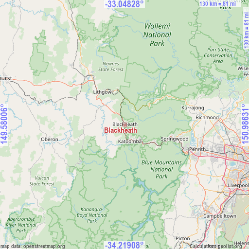
Blackheath GPS coordinates[2]
33° 38' 8.412" South, 150° 16' 59.448" East
| Map corner | latitude | longitude |
|---|---|---|
| Upper-left | -33.04828°, | 149.58006° |
| Center: | -33.63567°, | 150.28318° |
| Lower-right: | -34.21908°, | 150.98631° |
| Map W x H: | 130.2×130.2 km | = 80.9×80.9mi |
| max Lat: | -10.58257° ⇑47.7% North |
| Blackheath: | -33.63567° |
| min Lat: | ⇓52.3% South -43.31423° |
| min Long | Blackheath | max Long |
| 113.53327° | 150.28318° | 153.61246° |
| W 57.8%⇐ | ⇒42.2% E |
Elevation
Elevation of Blackheath is 1063 m = 3488 ft, and this is 941 m = 3087 ft above average elevation for this country.
| Max E: |
1715 m = 5627 ft | 0.2% |
| Blackheath | 1063 m 3488 ft | |
| Avg. | 122 m = 400 ft | |
Min E: |
-2 m = -7 ft | 99.8% |
See also: Australia elevation on elevation.city.
Geographical zone
Blackheath is located in South temperate zone (between Tropic of Capricorn and the Antarctic Circle). Distance of this Southern Tropic circle is 1134 km =704.6 mi to North.| Distance of | km | miles | from Blackheath |
|---|---|---|---|
| Equator | 3739.9 | 2323.9 | to North |
| Tropic Capricorn | 1134 | 704.6 | to North |
| Antarctic Circle | 3661.2 | 2275 | to South |
| South Pole | 6267.1 | 3894.2 | to South |


Nearby cities:
15 places around Blackheath: (largest is in red/bold)
• Bowenfels
21.8 km =13.5 mi,  320°
320°
• Bullaburra
16.2 km =10.1 mi,  129°
129°
• Faulconbridge
24.2 km =15 mi,  107°
107°
• Hazelbrook
19 km =11.8 mi,  121°
121°
• Katoomba
9.6 km =6 mi,  166°
166°
• Lawson
16.5 km =10.3 mi, 124°
• Leura
10.1 km =6.3 mi,  152°
152°
• Lithgow
20.9 km =13 mi, 323°
• Littleton
20.5 km =12.7 mi, 319°
• Medlow Bath
4.4 km =2.7 mi,  185°
185°
• Morts Estate
21.5 km =13.4 mi,  330°
330°
• Mount Victoria
5.6 km =3.5 mi, 332°
• South Bowenfels
20.3 km =12.6 mi,  310°
310°
• Wentworth Falls
11.9 km =7.4 mi, 134°
• Woodford
21.5 km =13.4 mi, 120°
Sources, notices
• [Note1] Compared only with cities in Australia existing in our database
• [Src1] Map data: © OpenStreetMap contributors (CC-BY-SA)
• [Src2] Other city data from geonames.org with taken over terms of usage.
• [Src3] Geographical zone / Annual Mean Temperature by Robert A. Rohde @ Wikipedia
