Vacy geodata
Vacy (New South Wales) is a populated place; located in Australia in Australia/Sydney (GMT+11) time zone. With population of 658 people, there are 4414 cities with bigger population in this country. Compared to other cities in Australia, 61.4% of cities are located further ↓South; 78.5% of cities are located further ←West and 59.2% of cities have higher elevation than Vacy. Note1


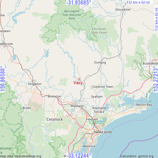
Vacy GPS coordinates[2]
32° 31' 53.76" South, 151° 34' 8.4" East
| Map corner | latitude | longitude |
|---|---|---|
| Upper-left | -31.93685°, | 150.86588° |
| Center: | -32.5316°, | 151.569° |
| Lower-right: | -33.12244°, | 152.27213° |
| Map W x H: | 131.8×131.8 km | = 81.9×81.9mi |
| max Lat: | -10.58257° ⇑38.6% North |
| Vacy: | -32.5316° |
| min Lat: | ⇓61.4% South -43.31423° |
| min Long | Vacy | max Long |
| 113.53327° | 151.569° | 153.61246° |
| W 78.5%⇐ | ⇒21.5% E |
Elevation
Elevation of Vacy is 33 m = 108 ft, and this is 89 m = 292 ft below average elevation for this country.
| Max E: |
1715 m = 5627 ft | 59.2% |
| Avg. | 122 m = 400 ft | |
| Vacy | 33 m = 108 ft | |
Min E: |
-2 m = -7 ft | 40.8% |
See also: Australia elevation on elevation.city.
Geographical zone
Vacy is located in South temperate zone (between Tropic of Capricorn and the Antarctic Circle). Distance of this Southern Tropic circle is 1011.3 km =628.4 mi to North.| Distance of | km | miles | from Vacy |
|---|---|---|---|
| Equator | 3617.2 | 2247.6 | to North |
| Tropic Capricorn | 1011.3 | 628.4 | to North |
| Antarctic Circle | 3784 | 2351.3 | to South |
| South Pole | 6389.9 | 3970.5 | to South |


Nearby cities:
15 places around Vacy: (largest is in red/bold)
• Aberglasslyn
19 km =11.8 mi,  190°
190°
• Bolwarra
20.6 km =12.8 mi,  180°
180°
• Bolwarra Heights
18.9 km =11.7 mi, 175°
• Brandy Hill
21.2 km =13.2 mi,  145°
145°
• Clarence Town
20.4 km =12.7 mi,  106°
106°
• Dungog
22.2 km =13.8 mi,  50°
50°
• Duns Creek
12.8 km =8 mi, 151°
• Largs
18.9 km =11.7 mi,  171°
171°
• Lochinvar
21.4 km =13.3 mi,  209°
209°
• Lorn
21.7 km =13.5 mi, 179°
• Paterson
9.4 km =5.8 mi, 152°
• Rutherford
20.8 km =12.9 mi, 189°
• Seaham
20.7 km =12.9 mi,  134°
134°
• Wallalong
19.7 km =12.2 mi,  157°
157°
• Windella
20.8 km =12.9 mi,  203°
203°
Sources, notices
• [Note1] Compared only with cities in Australia existing in our database
• [Src1] Map data: © OpenStreetMap contributors (CC-BY-SA)
• [Src2] Other city data from geonames.org with taken over terms of usage.
• [Src3] Geographical zone / Annual Mean Temperature by Robert A. Rohde @ Wikipedia
