Tangambalanga geodata
Tangambalanga (Victoria) is a populated place; located in Australia in Australia/Melbourne (GMT+11) time zone. With population of 539 people, there are 4752 cities with bigger population in this country. Compared to other cities in Australia, 79.3% of cities are located further ↑North; 53% of cities are located further →East and 80.6% of cities have lower elevation than Tangambalanga. Note1


Tangambalanga GPS coordinates[2]
36° 15' 7.812" South, 147° 1' 43.068" East
| Map corner | latitude | longitude |
|---|---|---|
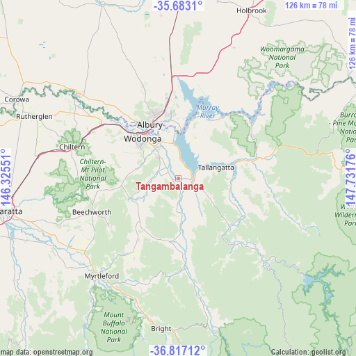
| Upper-left | -35.6831°, | 146.32551° |
| Center: | -36.25217°, | 147.02863° |
| Lower-right: | -36.81712°, | 147.73176° |
| Map W x H: | 126.1×126.1 km | = 78.4×78.4mi |
| max Lat: | -10.58257° ⇑79.3% North |
| Tangambalanga: | -36.25217° |
| min Lat: | ⇓20.7% South -43.31423° |
| min Long | Tangambalanga | max Long |
| 113.53327° | 147.02863° | 153.61246° |
| W 47%⇐ | ⇒53% E |
Elevation
Elevation of Tangambalanga is 187 m = 614 ft, and this is 65 m = 213 ft above average elevation for this country.
| Max E: |
1715 m = 5627 ft | 19.4% |
| Tangambalanga | 187 m 614 ft | |
| Avg. | 122 m = 400 ft | |
Min E: |
-2 m = -7 ft | 80.6% |
See also: Australia elevation on elevation.city.
Geographical zone
Tangambalanga is located in South temperate zone (between Tropic of Capricorn and the Antarctic Circle). Distance of this Southern Tropic circle is 1424.9 km =885.4 mi to North.| Distance of | km | miles | from Tangambalanga |
|---|---|---|---|
| Equator | 4030.9 | 2504.7 | to North |
| Tropic Capricorn | 1424.9 | 885.4 | to North |
| Antarctic Circle | 3370.3 | 2094.2 | to South |
| South Pole | 5976.2 | 3713.4 | to South |


Nearby cities:
15 places around Tangambalanga: (largest is in red/bold)
• Albury
21.8 km =13.5 mi,  334°
334°
• Bandiana
14.8 km =9.2 mi,  321°
321°
• Baranduda
9.5 km =5.9 mi, 315°
• Bonegilla
12.6 km =7.8 mi,  350°
350°
• East Albury
20.9 km =13 mi, 334°
• Killara
14.3 km =8.9 mi, 331°
• Leneva
12.2 km =7.6 mi,  288°
288°
• North Albury
23.4 km =14.5 mi,  337°
337°
• South Albury
21.3 km =13.2 mi, 329°
• Tallangatta
13.8 km =8.6 mi,  74°
74°
• Thurgoona
24.2 km =15 mi, 353°
• West Albury
22.7 km =14.1 mi, 327°
• West Wodonga
21.4 km =13.3 mi,  312°
312°
• Wodonga
19.2 km =11.9 mi, 318°
• Yackandandah
18.3 km =11.4 mi,  248°
248°
Sources, notices
• [Note1] Compared only with cities in Australia existing in our database
• [Src1] Map data: © OpenStreetMap contributors (CC-BY-SA)
• [Src2] Other city data from geonames.org with taken over terms of usage.
• [Src3] Geographical zone / Annual Mean Temperature by Robert A. Rohde @ Wikipedia
