Palmers Island geodata
Palmers Island (New South Wales) is a populated place; located in Australia in Australia/Sydney (GMT+11) time zone. With population of 564 people, there are 4670 cities with bigger population in this country. Compared to other cities in Australia, 72.9% of cities are located further ↓South; 97.6% of cities are located further ←West and 99.9% of cities have higher elevation than Palmers Island. Note1


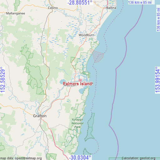
Palmers Island GPS coordinates[2]
29° 25' 11.28" South, 153° 17' 18.276" East
| Map corner | latitude | longitude |
|---|---|---|
| Upper-left | -28.80551°, | 152.58529° |
| Center: | -29.4198°, | 153.28841° |
| Lower-right: | -30.0304°, | 153.99154° |
| Map W x H: | 136.2×136.2 km | = 84.6×84.6mi |
| max Lat: | -10.58257° ⇑27.1% North |
| Palmers Island: | -29.4198° |
| min Lat: | ⇓72.9% South -43.31423° |
| min Long | Palmers Island | max Long |
| 113.53327° | 153.28841° | 153.61246° |
| W 97.6%⇐ | ⇒2.4% E |
Elevation
Elevation of Palmers Island is 1 m = 3 ft, and this is 121 m = 397 ft below average elevation for this country.
| Max E: |
1715 m = 5627 ft | 99.9% |
| Avg. | 122 m = 400 ft | |
| Palmers Island | 1 m = 3 ft | |
Min E: |
-2 m = -7 ft | 0.1% |
See also: Australia elevation on elevation.city.
Geographical zone
Palmers Island is located in South temperate zone (between Tropic of Capricorn and the Antarctic Circle). Distance of this Southern Tropic circle is 665.3 km =413.4 mi to North.| Distance of | km | miles | from Palmers Island |
|---|---|---|---|
| Equator | 3271.2 | 2032.6 | to North |
| Tropic Capricorn | 665.3 | 413.4 | to North |
| Antarctic Circle | 4130 | 2566.3 | to South |
| South Pole | 6735.9 | 4185.5 | to South |


Nearby cities:
15 places around Palmers Island: (largest is in red/bold)
• Clarenza
42.1 km =26.2 mi,  221°
221°
• Coraki
47.5 km =29.5 mi,  359°
359°
• Evans Head
36.3 km =22.6 mi,  22°
22°
• Grafton
44.9 km =27.9 mi,  229°
229°
• Gulmarrad
9.2 km =5.7 mi, 215°
• Iluka
6.4 km =4 mi,  71°
71°
• Junction Hill
42.9 km =26.7 mi,  235°
235°
• Lawrence
20.2 km =12.6 mi,  246°
246°
• Maclean
9.8 km =6.1 mi, 244°
• South Grafton
47.4 km =29.5 mi, 227°
• Townsend
8.3 km =5.2 mi, 231°
• Ulmarra
34.4 km =21.4 mi, 226°
• Woodburn
39.1 km =24.3 mi,  8°
8°
• Woombah
6.5 km =4 mi,  354°
354°
• Yamba
7.1 km =4.4 mi,  106°
106°
Sources, notices
• [Note1] Compared only with cities in Australia existing in our database
• [Src1] Map data: © OpenStreetMap contributors (CC-BY-SA)
• [Src2] Other city data from geonames.org with taken over terms of usage.
• [Src3] Geographical zone / Annual Mean Temperature by Robert A. Rohde @ Wikipedia
