Ormiston geodata
Ormiston (Queensland) is a section of populated place; located in Australia in Australia/Brisbane (GMT+10) time zone. With population of 5,669 people, there are 1294 cities with bigger population in this country. Compared to other cities in Australia, 81.6% of cities are located further ↓South; 97.2% of cities are located further ←West and 83.5% of cities have higher elevation than Ormiston. Note1


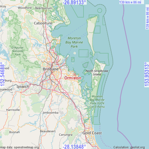
Ormiston GPS coordinates[2]
27° 31' 0.012" South, 153° 15' 0" East
| Map corner | latitude | longitude |
|---|---|---|
| Upper-left | -26.89133°, | 152.54688° |
| Center: | -27.51667°, | 153.25° |
| Lower-right: | -28.13848°, | 153.95313° |
| Map W x H: | 138.7×138.7 km | = 86.2×86.2mi |
| max Lat: | -10.58257° ⇑18.4% North |
| Ormiston: | -27.51667° |
| min Lat: | ⇓81.6% South -43.31423° |
| min Long | Ormiston | max Long |
| 113.53327° | 153.25° | 153.61246° |
| W 97.2%⇐ | ⇒2.8% E |
Elevation
Elevation of Ormiston is 13 m = 43 ft, and this is 109 m = 358 ft below average elevation for this country.
| Max E: |
1715 m = 5627 ft | 83.5% |
| Avg. | 122 m = 400 ft | |
| Ormiston | 13 m = 43 ft | |
Min E: |
-2 m = -7 ft | 16.5% |
See also: Australia elevation on elevation.city.
Geographical zone
Ormiston is located in South temperate zone (between Tropic of Capricorn and the Antarctic Circle). Distance of this Southern Tropic circle is 453.6 km =281.9 mi to North.| Distance of | km | miles | from Ormiston |
|---|---|---|---|
| Equator | 3059.6 | 1901.1 | to North |
| Tropic Capricorn | 453.6 | 281.9 | to North |
| Antarctic Circle | 4341.6 | 2697.7 | to South |
| South Pole | 6947.5 | 4317 | to South |


Nearby cities:
15 places around Ormiston: (largest is in red/bold)
• Alexandra Hills
2.7 km =1.7 mi,  230°
230°
• Birkdale
5 km =3.1 mi,  318°
318°
• Capalaba
5.5 km =3.4 mi,  237°
237°
• Chandler
10 km =6.2 mi,  271°
271°
• Cleveland
1.9 km =1.2 mi,  126°
126°
• Coochiemudlo Island
10.1 km =6.3 mi, 128°
• Gumdale
9.9 km =6.2 mi,  286°
286°
• Lota
8.2 km =5.1 mi,  309°
309°
• Manly West
9.5 km =5.9 mi,  300°
300°
• Sheldon
9 km =5.6 mi,  212°
212°
• Thorneside
6 km =3.7 mi, 302°
• Thornlands
4.8 km =3 mi,  162°
162°
• Victoria Point
9.6 km =6 mi,  140°
140°
• Wakerley
10 km =6.2 mi, 291°
• Wellington Point
3.7 km =2.3 mi,  0°
0°
Sources, notices
• [Note1] Compared only with cities in Australia existing in our database
• [Src1] Map data: © OpenStreetMap contributors (CC-BY-SA)
• [Src2] Other city data from geonames.org with taken over terms of usage.
• [Src3] Geographical zone / Annual Mean Temperature by Robert A. Rohde @ Wikipedia
