Coochiemudlo Island geodata
Coochiemudlo Island (Queensland) is a section of populated place; located in Australia in Australia/Brisbane (GMT+10) time zone. With population of 742 people, there are 4255 cities with bigger population in this country. Compared to other cities in Australia, 80% of cities are located further ↓South; 97.8% of cities are located further ←West and 88.3% of cities have higher elevation than Coochiemudlo Island. Note1


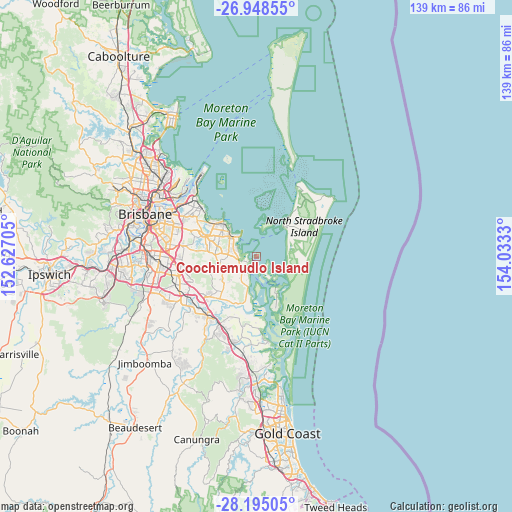
Coochiemudlo Island GPS coordinates[2]
27° 34' 24.852" South, 153° 19' 48.612" East
| Map corner | latitude | longitude |
|---|---|---|
| Upper-left | -26.94855°, | 152.62705° |
| Center: | -27.57357°, | 153.33017° |
| Lower-right: | -28.19505°, | 154.0333° |
| Map W x H: | 138.6×138.6 km | = 86.1×86.1mi |
| max Lat: | -10.58257° ⇑20% North |
| Coochiemudlo Island: | -27.57357° |
| min Lat: | ⇓80% South -43.31423° |
| min Long | Coochiemudlo Is | max Long |
| 113.53327° | 153.33017° | 153.61246° |
| W 97.8%⇐ | ⇒2.2% E |
Elevation
Elevation of Coochiemudlo Island is 10 m = 33 ft, and this is 112 m = 367 ft below average elevation for this country.
| Max E: |
1715 m = 5627 ft | 88.3% |
| Avg. | 122 m = 400 ft | |
| Coochiemudlo Island | 10 m = 33 ft | |
Min E: |
-2 m = -7 ft | 11.7% |
See also: Australia elevation on elevation.city.
Geographical zone
Coochiemudlo Island is located in South temperate zone (between Tropic of Capricorn and the Antarctic Circle). Distance of this Southern Tropic circle is 460 km =285.8 mi to North.| Distance of | km | miles | from Coochiemudlo Island |
|---|---|---|---|
| Equator | 3065.9 | 1905.1 | to North |
| Tropic Capricorn | 460 | 285.8 | to North |
| Antarctic Circle | 4335.3 | 2693.8 | to South |
| South Pole | 6941.2 | 4313.1 | to South |


Nearby cities:
15 places around Coochiemudlo Island: (largest is in red/bold)
• Alexandra Hills
11 km =6.8 mi,  294°
294°
• Birkdale
15 km =9.3 mi,  311°
311°
• Capalaba
13 km =8.1 mi, 285°
• Carbrook
14.5 km =9 mi,  212°
212°
• Cleveland
8.3 km =5.2 mi, 309°
• Dunwich
10.9 km =6.8 mi,  40°
40°
• Macleay Island
5.1 km =3.2 mi,  144°
144°
• Mount Cotton
11.6 km =7.2 mi,  235°
235°
• Ormiston
10.1 km =6.3 mi, 308°
• Redland Bay
5.1 km =3.2 mi,  215°
215°
• Russell Island
9.7 km =6 mi,  148°
148°
• Sheldon
12.8 km =8 mi,  264°
264°
• Thornlands
6.7 km =4.2 mi, 285°
• Victoria Point
2.1 km =1.3 mi, 239°
• Wellington Point
12.8 km =8 mi,  321°
321°
Sources, notices
• [Note1] Compared only with cities in Australia existing in our database
• [Src1] Map data: © OpenStreetMap contributors (CC-BY-SA)
• [Src2] Other city data from geonames.org with taken over terms of usage.
• [Src3] Geographical zone / Annual Mean Temperature by Robert A. Rohde @ Wikipedia
