McKinnon geodata
McKinnon (Victoria) is a section of populated place; located in Australia in Australia/Melbourne (GMT+11) time zone. With population of 5,553 people, there are 1329 cities with bigger population in this country. Compared to other cities in Australia, 90.8% of cities are located further ↑North; 65.3% of cities are located further →East and 52.4% of cities have higher elevation than McKinnon. Note1


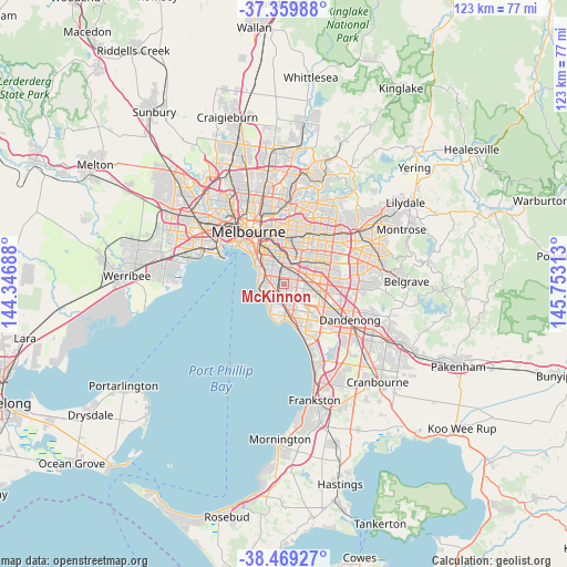
McKinnon GPS coordinates[2]
37° 55' 0.012" South, 145° 3' 0" East
| Map corner | latitude | longitude |
|---|---|---|
| Upper-left | -37.35988°, | 144.34688° |
| Center: | -37.91667°, | 145.05° |
| Lower-right: | -38.46927°, | 145.75313° |
| Map W x H: | 123.4×123.4 km | = 76.7×76.7mi |
| max Lat: | -10.58257° ⇑90.8% North |
| McKinnon: | -37.91667° |
| min Lat: | ⇓9.2% South -43.31423° |
| min Long | McKinnon | max Long |
| 113.53327° | 145.05° | 153.61246° |
| W 34.7%⇐ | ⇒65.3% E |
Elevation
Elevation of McKinnon is 42 m = 138 ft, and this is 80 m = 262 ft below average elevation for this country.
| Max E: |
1715 m = 5627 ft | 52.4% |
| Avg. | 122 m = 400 ft | |
| McKinnon | 42 m = 138 ft | |
Min E: |
-2 m = -7 ft | 47.6% |
See also: Australia elevation on elevation.city.
Geographical zone
McKinnon is located in South temperate zone (between Tropic of Capricorn and the Antarctic Circle). Distance of this Southern Tropic circle is 1610 km =1000.4 mi to North.| Distance of | km | miles | from McKinnon |
|---|---|---|---|
| Equator | 4215.9 | 2619.6 | to North |
| Tropic Capricorn | 1610 | 1000.4 | to North |
| Antarctic Circle | 3185.2 | 1979.2 | to South |
| South Pole | 5791.1 | 3598.4 | to South |


Nearby cities:
15 places around McKinnon: (largest is in red/bold)
• Bentleigh
1.3 km =0.8 mi,  263°
263°
• Bentleigh East
0.4 km =0.2 mi,  137°
137°
• Brighton East
3.3 km =2.1 mi,  299°
299°
• Carnegie
2.6 km =1.6 mi,  10°
10°
• Caulfield South
3.1 km =1.9 mi,  317°
317°
• Glen Huntly
2.8 km =1.7 mi,  344°
344°
• Hampton East
2.9 km =1.8 mi,  219°
219°
• Highett
3.7 km =2.3 mi,  180°
180°
• Hughesdale
3.5 km =2.2 mi,  57°
57°
• Kooyong
3.7 km =2.3 mi, 180°
• Moorabbin
2.8 km =1.7 mi,  166°
166°
• Murrumbeena
2.4 km =1.5 mi,  38°
38°
• Oakleigh
3.9 km =2.4 mi, 58°
• Oakleigh South
3.7 km =2.3 mi,  102°
102°
• Ormond
2.4 km =1.5 mi, 321°
Sources, notices
• [Note1] Compared only with cities in Australia existing in our database
• [Src1] Map data: © OpenStreetMap contributors (CC-BY-SA)
• [Src2] Other city data from geonames.org with taken over terms of usage.
• [Src3] Geographical zone / Annual Mean Temperature by Robert A. Rohde @ Wikipedia
