Koumala geodata
Koumala (Queensland) is a populated place; located in Australia in Australia/Brisbane (GMT+10) time zone. With population of 808 people, there are 4127 cities with bigger population in this country. Compared to other cities in Australia, 92.8% of cities are located further ↓South; 55.7% of cities are located further ←West and 57.6% of cities have higher elevation than Koumala. Note1


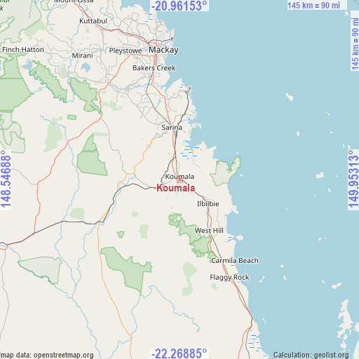
Koumala GPS coordinates[2]
21° 37' 0.012" South, 149° 15' 0" East
| Map corner | latitude | longitude |
|---|---|---|
| Upper-left | -20.96153°, | 148.54688° |
| Center: | -21.61667°, | 149.25° |
| Lower-right: | -22.26885°, | 149.95313° |
| Map W x H: | 145.4×145.4 km | = 90.3×90.3mi |
| max Lat: | -10.58257° ⇑7.2% North |
| Koumala: | -21.61667° |
| min Lat: | ⇓92.8% South -43.31423° |
| min Long | Koumala | max Long |
| 113.53327° | 149.25° | 153.61246° |
| W 55.7%⇐ | ⇒44.3% E |
Elevation
Elevation of Koumala is 35 m = 115 ft, and this is 87 m = 285 ft below average elevation for this country.
| Max E: |
1715 m = 5627 ft | 57.6% |
| Avg. | 122 m = 400 ft | |
| Koumala | 35 m = 115 ft | |
Min E: |
-2 m = -7 ft | 42.4% |
See also: Australia elevation on elevation.city.
Geographical zone
Koumala is located in South Torrid zone (between Equator and Tropic of Capricorn). Distance of this Southern Tropic circle is 202.4 km =125.8 mi to South.| Distance of | km | miles | from Koumala |
|---|---|---|---|
| Equator | 2403.5 | 1493.5 | to North |
| Tropic Capricorn | 202.4 | 125.8 | to South |
| Antarctic Circle | 4997.6 | 3105.4 | to South |
| South Pole | 7603.5 | 4724.6 | to South |


Nearby cities:
15 places around Koumala: (largest is in red/bold)
• Alligator Creek
31.9 km =19.8 mi,  350°
350°
• Armstrong Beach
19.2 km =11.9 mi,  11°
11°
• Bakers Creek
45.4 km =28.2 mi, 346°
• East Mackay
52.2 km =32.4 mi, 353°
• Eton
48.5 km =30.1 mi,  323°
323°
• Grasstree Beach
28.7 km =17.8 mi, 11°
• Hay Point
35.7 km =22.2 mi,  3°
3°
• Mackay
52.2 km =32.4 mi, 350°
• Mackay City
52.9 km =32.9 mi, 352°
• Ooralea
50.3 km =31.3 mi, 347°
• Sarina
22.2 km =13.8 mi, 351°
• Sarina Beach
26.1 km =16.2 mi, 13°
• South Mackay
51 km =31.7 mi, 351°
• Walkerston
54.4 km =33.8 mi,  338°
338°
• West Mackay
52.2 km =32.4 mi, 349°
Sources, notices
• [Note1] Compared only with cities in Australia existing in our database
• [Src1] Map data: © OpenStreetMap contributors (CC-BY-SA)
• [Src2] Other city data from geonames.org with taken over terms of usage.
• [Src3] Geographical zone / Annual Mean Temperature by Robert A. Rohde @ Wikipedia
