Armstrong Beach geodata
Armstrong Beach (Queensland) is a populated place; located in Australia in Australia/Brisbane (GMT+10) time zone. With population of 859 people, there are 4047 cities with bigger population in this country. Compared to other cities in Australia, 92.9% of cities are located further ↓South; 55.9% of cities are located further ←West and 80.4% of cities have higher elevation than Armstrong Beach. Note1


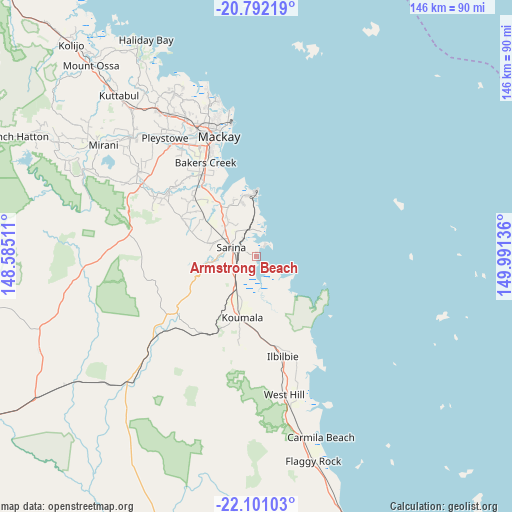
Armstrong Beach GPS coordinates[2]
21° 26' 53.088" South, 149° 17' 17.628" East
| Map corner | latitude | longitude |
|---|---|---|
| Upper-left | -20.79219°, | 148.58511° |
| Center: | -21.44808°, | 149.28823° |
| Lower-right: | -22.10103°, | 149.99136° |
| Map W x H: | 145.5×145.5 km | = 90.4×90.4mi |
| max Lat: | -10.58257° ⇑7.1% North |
| Armstrong Beach: | -21.44808° |
| min Lat: | ⇓92.9% South -43.31423° |
| min Long | Armstrong Beach | max Long |
| 113.53327° | 149.28823° | 153.61246° |
| W 55.9%⇐ | ⇒44.1% E |
Elevation
Elevation of Armstrong Beach is 15 m = 49 ft, and this is 107 m = 351 ft below average elevation for this country.
| Max E: |
1715 m = 5627 ft | 80.4% |
| Avg. | 122 m = 400 ft | |
| Armstrong Beach | 15 m = 49 ft | |
Min E: |
-2 m = -7 ft | 19.6% |
See also: Australia elevation on elevation.city.
Geographical zone
Armstrong Beach is located in South Torrid zone (between Equator and Tropic of Capricorn). Distance of this Southern Tropic circle is 221.1 km =137.4 mi to South.| Distance of | km | miles | from Armstrong Beach |
|---|---|---|---|
| Equator | 2384.8 | 1481.8 | to North |
| Tropic Capricorn | 221.1 | 137.4 | to South |
| Antarctic Circle | 5016.4 | 3117 | to South |
| South Pole | 7622.3 | 4736.3 | to South |


Nearby cities:
15 places around Armstrong Beach: (largest is in red/bold)
• Alligator Creek
15.7 km =9.8 mi,  324°
324°
• Bakers Creek
29.3 km =18.2 mi,  330°
330°
• East Mackay
34.5 km =21.4 mi,  343°
343°
• Eton
38.5 km =23.9 mi,  301°
301°
• Grasstree Beach
9.5 km =5.9 mi,  11°
11°
• Hay Point
16.9 km =10.5 mi,  354°
354°
• Koumala
19.2 km =11.9 mi,  191°
191°
• Mackay
35.1 km =21.8 mi, 338°
• Mackay City
35.3 km =21.9 mi, 342°
• North Mackay
38.2 km =23.7 mi, 342°
• Ooralea
33.8 km =21 mi, 334°
• Sarina
8.1 km =5 mi,  293°
293°
• Sarina Beach
7 km =4.3 mi,  17°
17°
• South Mackay
33.7 km =20.9 mi, 340°
• West Mackay
35.2 km =21.9 mi, 338°
Sources, notices
• [Note1] Compared only with cities in Australia existing in our database
• [Src1] Map data: © OpenStreetMap contributors (CC-BY-SA)
• [Src2] Other city data from geonames.org with taken over terms of usage.
• [Src3] Geographical zone / Annual Mean Temperature by Robert A. Rohde @ Wikipedia
