Kin Kin geodata
Kin Kin (Queensland) is a section of populated place; located in Australia in Australia/Brisbane (GMT+10) time zone. With population of 795 people, there are 4160 cities with bigger population in this country. Compared to other cities in Australia, 88.2% of cities are located further ↓South; 88.2% of cities are located further ←West and 61.4% of cities have lower elevation than Kin Kin. Note1


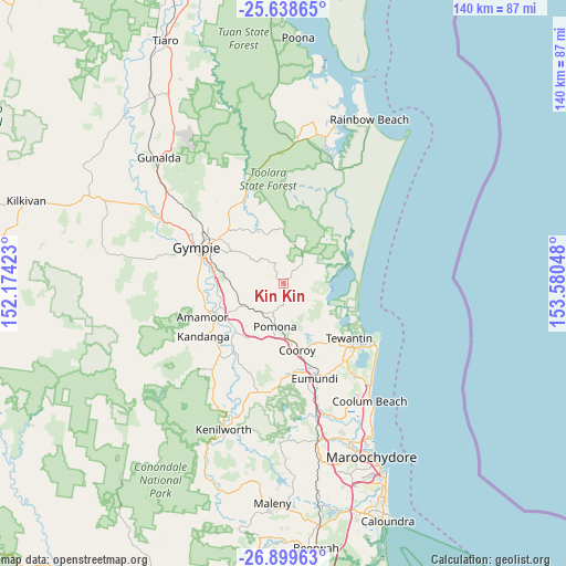
Kin Kin GPS coordinates[2]
26° 16' 15.06" South, 152° 52' 38.46" East
| Map corner | latitude | longitude |
|---|---|---|
| Upper-left | -25.63865°, | 152.17423° |
| Center: | -26.27085°, | 152.87735° |
| Lower-right: | -26.89963°, | 153.58048° |
| Map W x H: | 140.2×140.2 km | = 87.1×87.1mi |
| max Lat: | -10.58257° ⇑11.8% North |
| Kin Kin: | -26.27085° |
| min Lat: | ⇓88.2% South -43.31423° |
| min Long | Kin Kin | max Long |
| 113.53327° | 152.87735° | 153.61246° |
| W 88.2%⇐ | ⇒11.8% E |
Elevation
Elevation of Kin Kin is 68 m = 223 ft, and this is 54 m = 177 ft below average elevation for this country.
| Max E: |
1715 m = 5627 ft | 38.6% |
| Avg. | 122 m = 400 ft | |
| Kin Kin | 68 m = 223 ft | |
Min E: |
-2 m = -7 ft | 61.4% |
See also: Australia elevation on elevation.city.
Geographical zone
Kin Kin is located in South temperate zone (between Tropic of Capricorn and the Antarctic Circle). Distance of this Southern Tropic circle is 315.1 km =195.8 mi to North.| Distance of | km | miles | from Kin Kin |
|---|---|---|---|
| Equator | 2921 | 1815 | to North |
| Tropic Capricorn | 315.1 | 195.8 | to North |
| Antarctic Circle | 4480.1 | 2783.8 | to South |
| South Pole | 7086 | 4403 | to South |


Nearby cities:
15 places around Kin Kin: (largest is in red/bold)
• Amamoor
21.6 km =13.4 mi,  246°
246°
• Black Mountain
14.2 km =8.8 mi,  180°
180°
• Cooran
9.2 km =5.7 mi,  216°
216°
• Cooroibah
14.9 km =9.3 mi,  133°
133°
• Cooroy
16.7 km =10.4 mi,  168°
168°
• Cootharaba
8.9 km =5.5 mi,  87°
87°
• East Deep Creek
17.9 km =11.1 mi,  297°
297°
• Jones Hill
21.3 km =13.2 mi,  282°
282°
• Lake Macdonald
13.8 km =8.6 mi,  156°
156°
• Monkland
20.5 km =12.7 mi,  288°
288°
• Mothar Mountain
10.6 km =6.6 mi, 282°
• Pomona
10.9 km =6.8 mi,  191°
191°
• Tewantin
20.6 km =12.8 mi, 130°
• The Dawn
20 km =12.4 mi, 279°
• Tinbeerwah
18.2 km =11.3 mi,  144°
144°
Sources, notices
• [Note1] Compared only with cities in Australia existing in our database
• [Src1] Map data: © OpenStreetMap contributors (CC-BY-SA)
• [Src2] Other city data from geonames.org with taken over terms of usage.
• [Src3] Geographical zone / Annual Mean Temperature by Robert A. Rohde @ Wikipedia
