Green Hill geodata
Green Hill (New South Wales) is a populated place; located in Australia in Australia/Sydney (GMT+11) time zone. With population of 760 people, there are 4227 cities with bigger population in this country. Compared to other cities in Australia, 70.6% of cities are located further ↓South; 87% of cities are located further ←West and 64.8% of cities have higher elevation than Green Hill. Note1


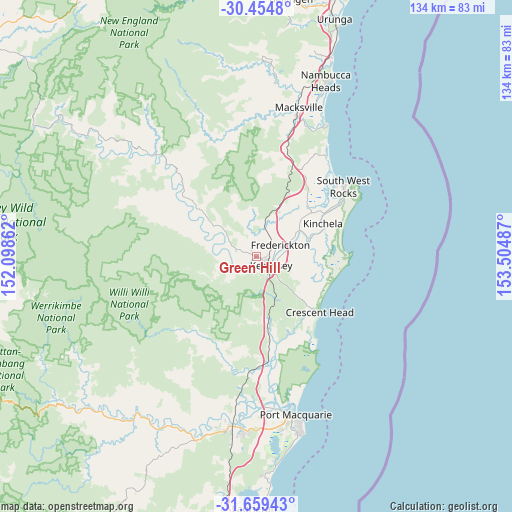
Green Hill GPS coordinates[2]
31° 3' 32.472" South, 152° 48' 6.264" East
| Map corner | latitude | longitude |
|---|---|---|
| Upper-left | -30.4548°, | 152.09862° |
| Center: | -31.05902°, | 152.80174° |
| Lower-right: | -31.65943°, | 153.50487° |
| Map W x H: | 133.9×133.9 km | = 83.2×83.2mi |
| max Lat: | -10.58257° ⇑29.4% North |
| Green Hill: | -31.05902° |
| min Lat: | ⇓70.6% South -43.31423° |
| min Long | Green Hill | max Long |
| 113.53327° | 152.80174° | 153.61246° |
| W 87%⇐ | ⇒13% E |
Elevation
Elevation of Green Hill is 27 m = 89 ft, and this is 95 m = 312 ft below average elevation for this country.
| Max E: |
1715 m = 5627 ft | 64.8% |
| Avg. | 122 m = 400 ft | |
| Green Hill | 27 m = 89 ft | |
Min E: |
-2 m = -7 ft | 35.2% |
See also: Australia elevation on elevation.city.
Geographical zone
Green Hill is located in South temperate zone (between Tropic of Capricorn and the Antarctic Circle). Distance of this Southern Tropic circle is 847.5 km =526.6 mi to North.| Distance of | km | miles | from Green Hill |
|---|---|---|---|
| Equator | 3453.4 | 2145.8 | to North |
| Tropic Capricorn | 847.5 | 526.6 | to North |
| Antarctic Circle | 3947.7 | 2453 | to South |
| South Pole | 6553.6 | 4072.2 | to South |


Nearby cities:
15 places around Green Hill: (largest is in red/bold)
• Aldavilla
4.1 km =2.5 mi,  231°
231°
• Collombatti
8.9 km =5.5 mi,  14°
14°
• Crescent Head
21.8 km =13.5 mi,  131°
131°
• Dondingalong
9.5 km =5.9 mi,  210°
210°
• East Kempsey
5.5 km =3.4 mi,  118°
118°
• Frederickton
7.4 km =4.6 mi,  71°
71°
• Kempsey
3.6 km =2.2 mi, 128°
• Kempsey city centre
3.8 km =2.4 mi, 122°
• Kundabung
17 km =10.6 mi,  170°
170°
• Smithtown
14.5 km =9 mi, 69°
• South Kempsey
7.7 km =4.8 mi,  157°
157°
• South West Rocks
29.9 km =18.6 mi,  49°
49°
• Telegraph Point
29.5 km =18.3 mi,  180°
180°
• West Kempsey
2.5 km =1.6 mi,  86°
86°
• Yarravel
4.2 km =2.6 mi,  295°
295°
Sources, notices
• [Note1] Compared only with cities in Australia existing in our database
• [Src1] Map data: © OpenStreetMap contributors (CC-BY-SA)
• [Src2] Other city data from geonames.org with taken over terms of usage.
• [Src3] Geographical zone / Annual Mean Temperature by Robert A. Rohde @ Wikipedia
