Colo Vale geodata
Colo Vale (New South Wales) is a populated place; located in Australia in Australia/Sydney (GMT+11) time zone. With population of 1,585 people, there are 3207 cities with bigger population in this country. Compared to other cities in Australia, 62.4% of cities are located further ↑North; 58.6% of cities are located further ←West and 97.6% of cities have lower elevation than Colo Vale. Note1


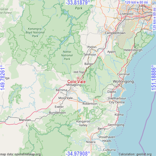
Colo Vale GPS coordinates[2]
34° 24' 3.42" South, 150° 29' 8.628" East
| Map corner | latitude | longitude |
|---|---|---|
| Upper-left | -33.81879°, | 149.78261° |
| Center: | -34.40095°, | 150.48573° |
| Lower-right: | -34.97908°, | 151.18886° |
| Map W x H: | 129×129 km | = 80.2×80.2mi |
| max Lat: | -10.58257° ⇑62.4% North |
| Colo Vale: | -34.40095° |
| min Lat: | ⇓37.6% South -43.31423° |
| min Long | Colo Vale | max Long |
| 113.53327° | 150.48573° | 153.61246° |
| W 58.6%⇐ | ⇒41.4% E |
Elevation
Elevation of Colo Vale is 647 m = 2123 ft, and this is 525 m = 1722 ft above average elevation for this country.
| Max E: |
1715 m = 5627 ft | 2.4% |
| Colo Vale | 647 m 2123 ft | |
| Avg. | 122 m = 400 ft | |
Min E: |
-2 m = -7 ft | 97.6% |
See also: Australia elevation on elevation.city.
Geographical zone
Colo Vale is located in South temperate zone (between Tropic of Capricorn and the Antarctic Circle). Distance of this Southern Tropic circle is 1219.1 km =757.5 mi to North.| Distance of | km | miles | from Colo Vale |
|---|---|---|---|
| Equator | 3825 | 2376.7 | to North |
| Tropic Capricorn | 1219.1 | 757.5 | to North |
| Antarctic Circle | 3576.1 | 2222.1 | to South |
| South Pole | 6182 | 3841.3 | to South |


Nearby cities:
15 places around Colo Vale: (largest is in red/bold)
• Bargo
14.7 km =9.1 mi,  35°
35°
• Berrima
16.5 km =10.3 mi,  234°
234°
• Bowral
10.4 km =6.5 mi,  215°
215°
• Burradoo
13.4 km =8.3 mi,  211°
211°
• Buxton
16.2 km =10.1 mi,  15°
15°
• Hill Top
6 km =3.7 mi,  8°
8°
• Mittagong
6.6 km =4.1 mi, 213°
• Moss Vale
20 km =12.4 mi, 211°
• New Berrima
17.9 km =11.1 mi, 230°
• Pheasants Nest
21.1 km =13.1 mi, 40°
• Renwick
5.5 km =3.4 mi,  195°
195°
• Welby
6.6 km =4.1 mi, 229°
• Willow Vale
4.1 km =2.5 mi, 200°
• Yanderra
12.2 km =7.6 mi, 42°
• Yerrinbool
6 km =3.7 mi,  53°
53°
Sources, notices
• [Note1] Compared only with cities in Australia existing in our database
• [Src1] Map data: © OpenStreetMap contributors (CC-BY-SA)
• [Src2] Other city data from geonames.org with taken over terms of usage.
• [Src3] Geographical zone / Annual Mean Temperature by Robert A. Rohde @ Wikipedia
