Bargo geodata
Bargo (New South Wales) is a populated place; located in Australia in Australia/Sydney (GMT+11) time zone. With population of 4,335 people, there are 1670 cities with bigger population in this country. Compared to other cities in Australia, 61.8% of cities are located further ↑North; 59.4% of cities are located further ←West and 88.8% of cities have lower elevation than Bargo. Note1


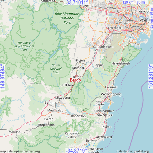
Bargo GPS coordinates[2]
34° 17' 34.836" South, 150° 34' 41.016" East
| Map corner | latitude | longitude |
|---|---|---|
| Upper-left | -33.71011°, | 149.87494° |
| Center: | -34.29301°, | 150.57806° |
| Lower-right: | -34.8719°, | 151.28119° |
| Map W x H: | 129.2×129.2 km | = 80.3×80.3mi |
| max Lat: | -10.58257° ⇑61.8% North |
| Bargo: | -34.29301° |
| min Lat: | ⇓38.2% South -43.31423° |
| min Long | Bargo | max Long |
| 113.53327° | 150.57806° | 153.61246° |
| W 59.4%⇐ | ⇒40.6% E |
Elevation
Elevation of Bargo is 340 m = 1115 ft, and this is 218 m = 715 ft above average elevation for this country.
| Max E: |
1715 m = 5627 ft | 11.2% |
| Bargo | 340 m 1115 ft | |
| Avg. | 122 m = 400 ft | |
Min E: |
-2 m = -7 ft | 88.8% |
See also: Australia elevation on elevation.city.
Geographical zone
Bargo is located in South temperate zone (between Tropic of Capricorn and the Antarctic Circle). Distance of this Southern Tropic circle is 1207.1 km =750.1 mi to North.| Distance of | km | miles | from Bargo |
|---|---|---|---|
| Equator | 3813 | 2369.3 | to North |
| Tropic Capricorn | 1207.1 | 750.1 | to North |
| Antarctic Circle | 3588.1 | 2229.5 | to South |
| South Pole | 6194 | 3848.8 | to South |


Nearby cities:
15 places around Bargo: (largest is in red/bold)
• Buxton
5.5 km =3.4 mi,  311°
311°
• Colo Vale
14.7 km =9.1 mi,  215°
215°
• Douglas Park
17.4 km =10.8 mi,  46°
46°
• Hill Top
9.7 km =6 mi,  231°
231°
• Pheasants Nest
6.6 km =4.1 mi, 51°
• Picton
14 km =8.7 mi,  12°
12°
• Razorback
17.1 km =10.6 mi,  23°
23°
• Renwick
19.9 km =12.4 mi,  209°
209°
• Tahmoor
8 km =5 mi, 11°
• Thirlmere
9.9 km =6.2 mi,  354°
354°
• Welby
21.2 km =13.2 mi, 219°
• Willow Vale
18.6 km =11.6 mi, 212°
• Wilton
12.4 km =7.7 mi,  62°
62°
• Yanderra
3 km =1.9 mi,  184°
184°
• Yerrinbool
9.2 km =5.7 mi,  203°
203°
Sources, notices
• [Note1] Compared only with cities in Australia existing in our database
• [Src1] Map data: © OpenStreetMap contributors (CC-BY-SA)
• [Src2] Other city data from geonames.org with taken over terms of usage.
• [Src3] Geographical zone / Annual Mean Temperature by Robert A. Rohde @ Wikipedia
