Belgrave geodata
Belgrave (Victoria) is a section of populated place; located in Australia in Australia/Melbourne (GMT+11) time zone. With population of 3,856 people, there are 1847 cities with bigger population in this country. Compared to other cities in Australia, 90.7% of cities are located further ↑North; 60.8% of cities are located further →East and 88.4% of cities have lower elevation than Belgrave. Note1


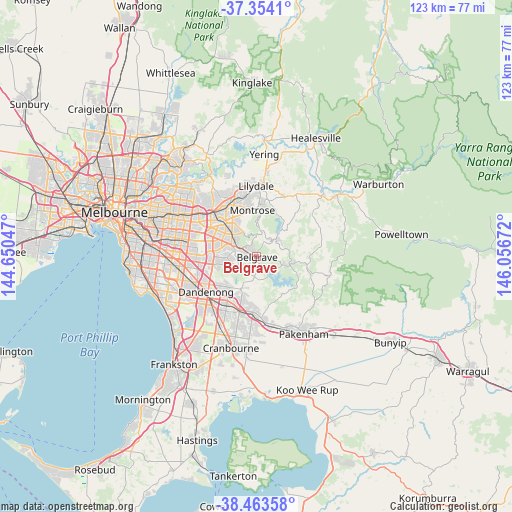
Belgrave GPS coordinates[2]
37° 54' 39.348" South, 145° 21' 12.924" East
| Map corner | latitude | longitude |
|---|---|---|
| Upper-left | -37.3541°, | 144.65047° |
| Center: | -37.91093°, | 145.35359° |
| Lower-right: | -38.46358°, | 146.05672° |
| Map W x H: | 123.4×123.4 km | = 76.7×76.7mi |
| max Lat: | -10.58257° ⇑90.7% North |
| Belgrave: | -37.91093° |
| min Lat: | ⇓9.3% South -43.31423° |
| min Long | Belgrave | max Long |
| 113.53327° | 145.35359° | 153.61246° |
| W 39.2%⇐ | ⇒60.8% E |
Elevation
Elevation of Belgrave is 324 m = 1063 ft, and this is 202 m = 663 ft above average elevation for this country.
| Max E: |
1715 m = 5627 ft | 11.6% |
| Belgrave | 324 m 1063 ft | |
| Avg. | 122 m = 400 ft | |
Min E: |
-2 m = -7 ft | 88.4% |
See also: Australia elevation on elevation.city.
Geographical zone
Belgrave is located in South temperate zone (between Tropic of Capricorn and the Antarctic Circle). Distance of this Southern Tropic circle is 1609.4 km =1000 mi to North.| Distance of | km | miles | from Belgrave |
|---|---|---|---|
| Equator | 4215.3 | 2619.3 | to North |
| Tropic Capricorn | 1609.4 | 1000 | to North |
| Antarctic Circle | 3185.9 | 1979.6 | to South |
| South Pole | 5791.8 | 3598.9 | to South |


Nearby cities:
15 places around Belgrave: (largest is in red/bold)
• Belgrave Heights
1.9 km =1.2 mi,  207°
207°
• Belgrave South
3.1 km =1.9 mi,  215°
215°
• Ferntree Gully
5.9 km =3.7 mi,  299°
299°
• Ferny Creek
3.5 km =2.2 mi,  329°
329°
• Kallista
2.9 km =1.8 mi,  60°
60°
• Lysterfield
5.3 km =3.3 mi,  242°
242°
• Menzies Creek
4.1 km =2.5 mi,  98°
98°
• Monbulk
7.5 km =4.7 mi, 57°
• Olinda
6.9 km =4.3 mi,  9°
9°
• Sassafras
4.9 km =3 mi,  356°
356°
• Selby
2.7 km =1.7 mi, 103°
• Tecoma
1.2 km =0.7 mi,  318°
318°
• The Basin
7.5 km =4.7 mi, 334°
• The Patch
4.8 km =3 mi, 63°
• Upwey
2.2 km =1.4 mi, 304°
Sources, notices
• [Note1] Compared only with cities in Australia existing in our database
• [Src1] Map data: © OpenStreetMap contributors (CC-BY-SA)
• [Src2] Other city data from geonames.org with taken over terms of usage.
• [Src3] Geographical zone / Annual Mean Temperature by Robert A. Rohde @ Wikipedia
