Como geodata
Como (Western Australia) is a section of populated place; located in Australia in Australia/Perth (GMT+8) time zone. With population of 13,965 people, there are 315 cities with bigger population in this country. Compared to other cities in Australia, 65.3% of cities are located further ↓South; 94.5% of cities are located further →East and 64.8% of cities have higher elevation than Como. Note1


Como GPS coordinates[2]
31° 59' 28.284" South, 115° 51' 48.096" East
| Map corner | latitude | longitude |
|---|---|---|
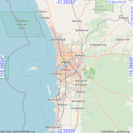
| Upper-left | -31.39292°, | 115.16024° |
| Center: | -31.99119°, | 115.86336° |
| Lower-right: | -32.58559°, | 116.56649° |
| Map W x H: | 132.6×132.6 km | = 82.4×82.4mi |
| max Lat: | -10.58257° ⇑34.7% North |
| Como: | -31.99119° |
| min Lat: | ⇓65.3% South -43.31423° |
| min Long | Como | max Long |
| 113.53327° | 115.86336° | 153.61246° |
| W 5.5%⇐ | ⇒94.5% E |
Elevation
Elevation of Como is 27 m = 89 ft, and this is 95 m = 312 ft below average elevation for this country.
| Max E: |
1715 m = 5627 ft | 64.8% |
| Avg. | 122 m = 400 ft | |
| Como | 27 m = 89 ft | |
Min E: |
-2 m = -7 ft | 35.2% |
See also: Australia elevation on elevation.city.
Geographical zone
Como is located in South temperate zone (between Tropic of Capricorn and the Antarctic Circle). Distance of this Southern Tropic circle is 951.2 km =591 mi to North.| Distance of | km | miles | from Como |
|---|---|---|---|
| Equator | 3557.1 | 2210.3 | to North |
| Tropic Capricorn | 951.2 | 591 | to North |
| Antarctic Circle | 3844.1 | 2388.6 | to South |
| South Pole | 6450 | 4007.8 | to South |


Nearby cities:
15 places around Como: (largest is in red/bold)
• Applecross
4 km =2.5 mi,  224°
224°
• Crawley
4.5 km =2.8 mi,  279°
279°
• East Perth
3.7 km =2.3 mi,  11°
11°
• East Victoria Park
3.8 km =2.4 mi,  86°
86°
• Karawara
2.6 km =1.6 mi,  139°
139°
• Lathlain
4.8 km =3 mi,  57°
57°
• Manning
2.8 km =1.7 mi,  172°
172°
• Perth
4.3 km =2.7 mi,  357°
357°
• Perth city centre
4.4 km =2.7 mi,  345°
345°
• Salter Point
3.6 km =2.2 mi,  176°
176°
• Shelley
4.8 km =3 mi,  152°
152°
• South Perth
0.9 km =0.6 mi,  19°
19°
• St James
4.5 km =2.8 mi,  102°
102°
• Victoria Park
4.3 km =2.7 mi,  67°
67°
• Waterford
3.5 km =2.2 mi, 141°
Sources, notices
• [Note1] Compared only with cities in Australia existing in our database
• [Src1] Map data: © OpenStreetMap contributors (CC-BY-SA)
• [Src2] Other city data from geonames.org with taken over terms of usage.
• [Src3] Geographical zone / Annual Mean Temperature by Robert A. Rohde @ Wikipedia
