Palm Island geodata
Palm Island (Queensland) is a section of populated place; located in Australia in Australia/Brisbane (GMT+10) time zone. With population of 2,516 people, there are 2558 cities with bigger population in this country. Compared to other cities in Australia, 95.9% of cities are located further ↓South; 55.2% of cities are located further →East and 95.5% of cities have higher elevation than Palm Island. Note1


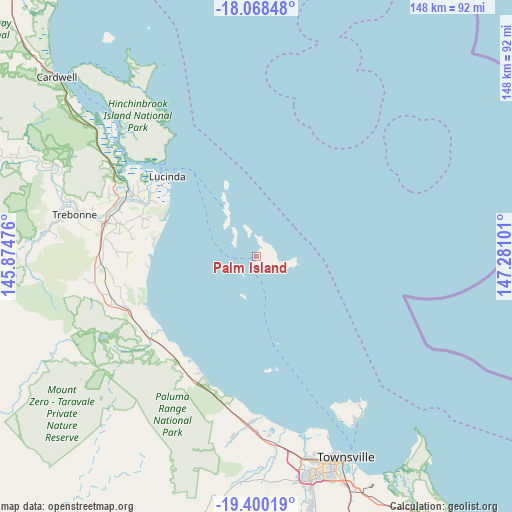
Palm Island GPS coordinates[2]
18° 44' 8.34" South, 146° 34' 40.368" East
| Map corner | latitude | longitude |
|---|---|---|
| Upper-left | -18.06848°, | 145.87476° |
| Center: | -18.73565°, | 146.57788° |
| Lower-right: | -19.40019°, | 147.28101° |
| Map W x H: | 148.1×148.1 km | = 92×92mi |
| max Lat: | -10.58257° ⇑4.1% North |
| Palm Island: | -18.73565° |
| min Lat: | ⇓95.9% South -43.31423° |
| min Long | Palm Island | max Long |
| 113.53327° | 146.57788° | 153.61246° |
| W 44.8%⇐ | ⇒55.2% E |
Elevation
Elevation of Palm Island is 6 m = 20 ft, and this is 116 m = 381 ft below average elevation for this country.
| Max E: |
1715 m = 5627 ft | 95.5% |
| Avg. | 122 m = 400 ft | |
| Palm Island | 6 m = 20 ft | |
Min E: |
-2 m = -7 ft | 4.5% |
See also: Australia elevation on elevation.city.
Geographical zone
Palm Island is located in South Torrid zone (between Equator and Tropic of Capricorn). Distance of this Southern Tropic circle is 522.7 km =324.8 mi to South.| Distance of | km | miles | from Palm Island |
|---|---|---|---|
| Equator | 2083.2 | 1294.4 | to North |
| Tropic Capricorn | 522.7 | 324.8 | to South |
| Antarctic Circle | 5318 | 3304.5 | to South |
| South Pole | 7923.9 | 4923.7 | to South |


Nearby cities:
15 places around Palm Island: (largest is in red/bold)
• Balgal Beach
35.9 km =22.3 mi,  209°
209°
• Black River
54.6 km =33.9 mi,  175°
175°
• Bluewater
49.6 km =30.8 mi, 182°
• Bluewater Park
52.6 km =32.7 mi,  187°
187°
• Bushland Beach
51.7 km =32.1 mi,  168°
168°
• Deeragun
57.8 km =35.9 mi, 169°
• Horseshoe Bay
51.8 km =32.2 mi,  145°
145°
• Ingham
44.9 km =27.9 mi,  282°
282°
• Jensen
57.3 km =35.6 mi, 172°
• Lucinda
34.8 km =21.6 mi,  311°
311°
• Magnetic Island
54.6 km =33.9 mi, 148°
• Mount Low
56 km =34.8 mi, 170°
• Nelly Bay
55 km =34.2 mi, 148°
• Pallarenda
55.7 km =34.6 mi,  158°
158°
• Yabulu
51.8 km =32.2 mi, 178°
Sources, notices
• [Note1] Compared only with cities in Australia existing in our database
• [Src1] Map data: © OpenStreetMap contributors (CC-BY-SA)
• [Src2] Other city data from geonames.org with taken over terms of usage.
• [Src3] Geographical zone / Annual Mean Temperature by Robert A. Rohde @ Wikipedia
