Crestwood geodata
Crestwood (New South Wales) is a section of populated place; located in Australia in Australia/Sydney (GMT+11) time zone. With population of 4,556 people, there are 1612 cities with bigger population in this country. Compared to other cities in Australia, 76% of cities are located further ↑North; 55.6% of cities are located further ←West and 96.5% of cities have lower elevation than Crestwood. Note1


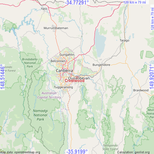
Crestwood GPS coordinates[2]
35° 20' 54.384" South, 149° 13' 3.288" East
| Map corner | latitude | longitude |
|---|---|---|
| Upper-left | -34.77291°, | 148.51446° |
| Center: | -35.34844°, | 149.21758° |
| Lower-right: | -35.9199°, | 149.92071° |
| Map W x H: | 127.5×127.5 km | = 79.2×79.2mi |
| max Lat: | -10.58257° ⇑76% North |
| Crestwood: | -35.34844° |
| min Lat: | ⇓24% South -43.31423° |
| min Long | Crestwood | max Long |
| 113.53327° | 149.21758° | 153.61246° |
| W 55.6%⇐ | ⇒44.4% E |
Elevation
Elevation of Crestwood is 616 m = 2021 ft, and this is 494 m = 1621 ft above average elevation for this country.
| Max E: |
1715 m = 5627 ft | 3.5% |
| Crestwood | 616 m 2021 ft | |
| Avg. | 122 m = 400 ft | |
Min E: |
-2 m = -7 ft | 96.5% |
See also: Australia elevation on elevation.city.
Geographical zone
Crestwood is located in South temperate zone (between Tropic of Capricorn and the Antarctic Circle). Distance of this Southern Tropic circle is 1324.5 km =823 mi to North.| Distance of | km | miles | from Crestwood |
|---|---|---|---|
| Equator | 3930.4 | 2442.2 | to North |
| Tropic Capricorn | 1324.5 | 823 | to North |
| Antarctic Circle | 3470.8 | 2156.7 | to South |
| South Pole | 6076.7 | 3775.9 | to South |


Nearby cities:
15 places around Crestwood: (largest is in red/bold)
• Barton
8.5 km =5.3 mi,  304°
304°
• Campbell
8.8 km =5.5 mi,  318°
318°
• Forrest
8.9 km =5.5 mi,  294°
294°
• Greenleigh
3.8 km =2.4 mi,  122°
122°
• Griffith
7.7 km =4.8 mi, 289°
• Isaacs
9.5 km =5.9 mi,  256°
256°
• Jerrabomberra
4.2 km =2.6 mi,  198°
198°
• Karabar
3.4 km =2.1 mi,  155°
155°
• Kingston
7.4 km =4.6 mi, 299°
• Narrabundah
6.4 km =4 mi,  282°
282°
• Queanbeyan
1.5 km =0.9 mi, 118°
• Queanbeyan East
2.6 km =1.6 mi,  84°
84°
• Queanbeyan West
1.4 km =0.9 mi,  239°
239°
• Red Hill
9.3 km =5.8 mi, 285°
• Symonston
5.3 km =3.3 mi,  266°
266°
Sources, notices
• [Note1] Compared only with cities in Australia existing in our database
• [Src1] Map data: © OpenStreetMap contributors (CC-BY-SA)
• [Src2] Other city data from geonames.org with taken over terms of usage.
• [Src3] Geographical zone / Annual Mean Temperature by Robert A. Rohde @ Wikipedia
