Jerrabomberra geodata
Jerrabomberra (New South Wales) is a section of populated place; located in Australia in Australia/Sydney (GMT+11) time zone. With population of 9,240 people, there are 673 cities with bigger population in this country. Compared to other cities in Australia, 76.5% of cities are located further ↑North; 55.4% of cities are located further ←West and 96.5% of cities have lower elevation than Jerrabomberra. Note1


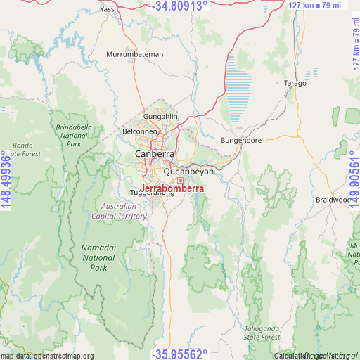
Jerrabomberra GPS coordinates[2]
35° 23' 3.876" South, 149° 12' 8.928" East
| Map corner | latitude | longitude |
|---|---|---|
| Upper-left | -34.80913°, | 148.49936° |
| Center: | -35.38441°, | 149.20248° |
| Lower-right: | -35.95562°, | 149.90561° |
| Map W x H: | 127.5×127.5 km | = 79.2×79.2mi |
| max Lat: | -10.58257° ⇑76.5% North |
| Jerrabomberra: | -35.38441° |
| min Lat: | ⇓23.5% South -43.31423° |
| min Long | Jerrabomberra | max Long |
| 113.53327° | 149.20248° | 153.61246° |
| W 55.4%⇐ | ⇒44.6% E |
Elevation
Elevation of Jerrabomberra is 618 m = 2028 ft, and this is 496 m = 1627 ft above average elevation for this country.
| Max E: |
1715 m = 5627 ft | 3.5% |
| Jerrabomberra | 618 m 2028 ft | |
| Avg. | 122 m = 400 ft | |
Min E: |
-2 m = -7 ft | 96.5% |
See also: Australia elevation on elevation.city.
Geographical zone
Jerrabomberra is located in South temperate zone (between Tropic of Capricorn and the Antarctic Circle). Distance of this Southern Tropic circle is 1328.5 km =825.5 mi to North.| Distance of | km | miles | from Jerrabomberra |
|---|---|---|---|
| Equator | 3934.4 | 2444.7 | to North |
| Tropic Capricorn | 1328.5 | 825.5 | to North |
| Antarctic Circle | 3466.8 | 2154.2 | to South |
| South Pole | 6072.7 | 3773.4 | to South |


Nearby cities:
15 places around Jerrabomberra: (largest is in red/bold)
• Chisholm
7.4 km =4.6 mi,  245°
245°
• Crestwood
4.2 km =2.6 mi,  18°
18°
• Fadden
8.1 km =5 mi, 253°
• Gilmore
7.3 km =4.5 mi,  237°
237°
• Googong
6.1 km =3.8 mi,  170°
170°
• Greenleigh
5 km =3.1 mi,  66°
66°
• Griffith
8.8 km =5.5 mi,  317°
317°
• Isaacs
8.1 km =5 mi,  282°
282°
• Karabar
2.9 km =1.8 mi, 71°
• Macarthur
7.4 km =4.6 mi, 248°
• Narrabundah
7.3 km =4.5 mi, 318°
• Queanbeyan
4.2 km =2.6 mi,  39°
39°
• Queanbeyan East
5.8 km =3.6 mi, 42°
• Queanbeyan West
3.3 km =2.1 mi,  2°
2°
• Symonston
5.4 km =3.4 mi,  312°
312°
Sources, notices
• [Note1] Compared only with cities in Australia existing in our database
• [Src1] Map data: © OpenStreetMap contributors (CC-BY-SA)
• [Src2] Other city data from geonames.org with taken over terms of usage.
• [Src3] Geographical zone / Annual Mean Temperature by Robert A. Rohde @ Wikipedia
