Tallai geodata
Tallai (Queensland) is a section of populated place; located in Australia in Australia/Brisbane (GMT+10) time zone. With population of 4,063 people, there are 1769 cities with bigger population in this country. Compared to other cities in Australia, 75.7% of cities are located further ↓South; 97.8% of cities are located further ←West and 70.8% of cities have lower elevation than Tallai. Note1


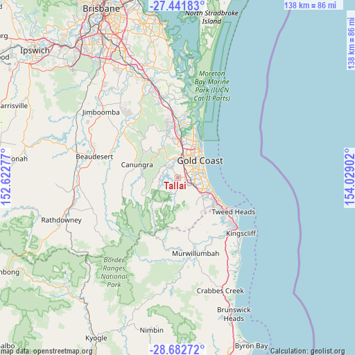
Tallai GPS coordinates[2]
28° 3' 50.652" South, 153° 19' 33.204" East
| Map corner | latitude | longitude |
|---|---|---|
| Upper-left | -27.44183°, | 152.62277° |
| Center: | -28.06407°, | 153.32589° |
| Lower-right: | -28.68272°, | 154.02902° |
| Map W x H: | 138×138 km | = 85.7×85.7mi |
| max Lat: | -10.58257° ⇑24.3% North |
| Tallai: | -28.06407° |
| min Lat: | ⇓75.7% South -43.31423° |
| min Long | Tallai | max Long |
| 113.53327° | 153.32589° | 153.61246° |
| W 97.8%⇐ | ⇒2.2% E |
Elevation
Elevation of Tallai is 108 m = 354 ft, and this is 14 m = 46 ft below average elevation for this country.
| Max E: |
1715 m = 5627 ft | 29.2% |
| Avg. | 122 m = 400 ft | |
| Tallai | 108 m = 354 ft | |
Min E: |
-2 m = -7 ft | 70.8% |
See also: Australia elevation on elevation.city.
Geographical zone
Tallai is located in South temperate zone (between Tropic of Capricorn and the Antarctic Circle). Distance of this Southern Tropic circle is 514.5 km =319.7 mi to North.| Distance of | km | miles | from Tallai |
|---|---|---|---|
| Equator | 3120.4 | 1938.9 | to North |
| Tropic Capricorn | 514.5 | 319.7 | to North |
| Antarctic Circle | 4280.7 | 2659.9 | to South |
| South Pole | 6886.6 | 4279.1 | to South |


Nearby cities:
15 places around Tallai: (largest is in red/bold)
• Advancetown
5.8 km =3.6 mi,  267°
267°
• Benowa
8.6 km =5.3 mi,  43°
43°
• Bonogin
8.8 km =5.5 mi,  162°
162°
• Carrara
6.2 km =3.9 mi, 39°
• Clear Island Waters
7.2 km =4.5 mi,  80°
80°
• Gilston
4.3 km =2.7 mi,  323°
323°
• Highland Park
5.6 km =3.5 mi,  7°
7°
• Lower Beechmont
8.1 km =5 mi,  283°
283°
• Merrimac
4.9 km =3 mi,  72°
72°
• Mudgeeraba
4.5 km =2.8 mi,  118°
118°
• Nerang
8.4 km =5.2 mi, 7°
• Reedy Creek
8.8 km =5.5 mi,  127°
127°
• Robina
6.7 km =4.2 mi,  96°
96°
• Varsity Lakes
8.9 km =5.5 mi,  108°
108°
• Worongary
2.8 km =1.7 mi,  56°
56°
Sources, notices
• [Note1] Compared only with cities in Australia existing in our database
• [Src1] Map data: © OpenStreetMap contributors (CC-BY-SA)
• [Src2] Other city data from geonames.org with taken over terms of usage.
• [Src3] Geographical zone / Annual Mean Temperature by Robert A. Rohde @ Wikipedia
