Winthrop geodata
Winthrop (Western Australia) is a section of populated place; located in Australia in Australia/Perth (GMT+8) time zone. With population of 5,804 people, there are 1255 cities with bigger population in this country. Compared to other cities in Australia, 64.2% of cities are located further ↓South; 95.4% of cities are located further →East and 62.8% of cities have higher elevation than Winthrop. Note1


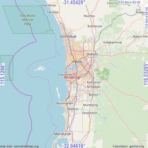
Winthrop GPS coordinates[2]
32° 3' 7.776" South, 115° 49' 46.992" East
| Map corner | latitude | longitude |
|---|---|---|
| Upper-left | -31.45428°, | 115.1266° |
| Center: | -32.05216°, | 115.82972° |
| Lower-right: | -32.64616°, | 116.53285° |
| Map W x H: | 132.5×132.5 km | = 82.3×82.3mi |
| max Lat: | -10.58257° ⇑35.8% North |
| Winthrop: | -32.05216° |
| min Lat: | ⇓64.2% South -43.31423° |
| min Long | Winthrop | max Long |
| 113.53327° | 115.82972° | 153.61246° |
| W 4.6%⇐ | ⇒95.4% E |
Elevation
Elevation of Winthrop is 29 m = 95 ft, and this is 93 m = 305 ft below average elevation for this country.
| Max E: |
1715 m = 5627 ft | 62.8% |
| Avg. | 122 m = 400 ft | |
| Winthrop | 29 m = 95 ft | |
Min E: |
-2 m = -7 ft | 37.2% |
See also: Australia elevation on elevation.city.
Geographical zone
Winthrop is located in South temperate zone (between Tropic of Capricorn and the Antarctic Circle). Distance of this Southern Tropic circle is 957.9 km =595.2 mi to North.| Distance of | km | miles | from Winthrop |
|---|---|---|---|
| Equator | 3563.9 | 2214.5 | to North |
| Tropic Capricorn | 957.9 | 595.2 | to North |
| Antarctic Circle | 3837.3 | 2384.4 | to South |
| South Pole | 6443.2 | 4003.6 | to South |


Nearby cities:
15 places around Winthrop: (largest is in red/bold)
• Alfred Cove
2.7 km =1.7 mi,  322°
322°
• Ardross
2.9 km =1.8 mi,  10°
10°
• Bateman
1.7 km =1.1 mi,  102°
102°
• Booragoon
1.5 km =0.9 mi, 14°
• Brentwood
2.4 km =1.5 mi,  65°
65°
• Bull Creek
3.1 km =1.9 mi, 98°
• Kardinya
2.1 km =1.3 mi,  223°
223°
• Melville
3 km =1.9 mi,  295°
295°
• Mount Pleasant
2.4 km =1.5 mi,  54°
54°
• Murdoch
2.1 km =1.3 mi,  159°
159°
• Myaree
1.8 km =1.1 mi, 319°
• North Lake
3.4 km =2.1 mi,  170°
170°
• Rossmoyne
3.8 km =2.4 mi, 68°
• Samson
3.6 km =2.2 mi,  236°
236°
• Willagee
2.3 km =1.4 mi,  270°
270°
Sources, notices
• [Note1] Compared only with cities in Australia existing in our database
• [Src1] Map data: © OpenStreetMap contributors (CC-BY-SA)
• [Src2] Other city data from geonames.org with taken over terms of usage.
• [Src3] Geographical zone / Annual Mean Temperature by Robert A. Rohde @ Wikipedia
