Whyalla Stuart geodata
Whyalla Stuart (South Australia) is a section of populated place; located in Australia in Australia/Adelaide (GMT+10.5) time zone. With population of 6,605 people, there are 1050 cities with bigger population in this country. Compared to other cities in Australia, 57.3% of cities are located further ↓South; 85.9% of cities are located further →East and 74.7% of cities have higher elevation than Whyalla Stuart. Note1


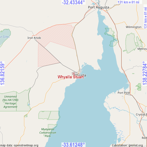
Whyalla Stuart GPS coordinates[2]
33° 1' 29.748" South, 137° 31' 28.956" East
| Map corner | latitude | longitude |
|---|---|---|
| Upper-left | -32.43344°, | 136.82159° |
| Center: | -33.02493°, | 137.52471° |
| Lower-right: | -33.61248°, | 138.22784° |
| Map W x H: | 131.1×131.1 km | = 81.5×81.5mi |
| max Lat: | -10.58257° ⇑42.7% North |
| Whyalla Stuart: | -33.02493° |
| min Lat: | ⇓57.3% South -43.31423° |
| min Long | Whyalla Stuart | max Long |
| 113.53327° | 137.52471° | 153.61246° |
| W 14.1%⇐ | ⇒85.9% E |
Elevation
Elevation of Whyalla Stuart is 19 m = 62 ft, and this is 103 m = 338 ft below average elevation for this country.
| Max E: |
1715 m = 5627 ft | 74.7% |
| Avg. | 122 m = 400 ft | |
| Whyalla Stuart | 19 m = 62 ft | |
Min E: |
-2 m = -7 ft | 25.3% |
See also: Australia elevation on elevation.city.
Geographical zone
Whyalla Stuart is located in South temperate zone (between Tropic of Capricorn and the Antarctic Circle). Distance of this Southern Tropic circle is 1066.1 km =662.4 mi to North.| Distance of | km | miles | from Whyalla Stuart |
|---|---|---|---|
| Equator | 3672 | 2281.7 | to North |
| Tropic Capricorn | 1066.1 | 662.4 | to North |
| Antarctic Circle | 3729.1 | 2317.2 | to South |
| South Pole | 6335 | 3936.4 | to South |


Nearby cities:
15 places around Whyalla Stuart: (largest is in red/bold)
• Napperby
57.1 km =35.5 mi,  104°
104°
• Port Augusta
63.2 km =39.3 mi,  21°
21°
• Port Augusta West
63.8 km =39.6 mi, 20°
• Port Pirie
49.5 km =30.8 mi,  112°
112°
• Port Pirie South
49.5 km =30.8 mi, 112°
• Port Pirie West
47.3 km =29.4 mi, 111°
• Risdon Park
47.7 km =29.6 mi, 113°
• Risdon Park South
48.4 km =30.1 mi,  115°
115°
• Solomontown
49.8 km =30.9 mi, 110°
• Stirling North
67.3 km =41.8 mi,  25°
25°
• Whyalla
3.8 km =2.4 mi, 102°
• Whyalla Jenkins
1.2 km =0.7 mi,  285°
285°
• Whyalla Norrie
1.4 km =0.9 mi, 108°
• Whyalla Playford
3.5 km =2.2 mi, 95°
• Wilmington
67.9 km =42.2 mi,  52°
52°
Sources, notices
• [Note1] Compared only with cities in Australia existing in our database
• [Src1] Map data: © OpenStreetMap contributors (CC-BY-SA)
• [Src2] Other city data from geonames.org with taken over terms of usage.
• [Src3] Geographical zone / Annual Mean Temperature by Robert A. Rohde @ Wikipedia
