Port Pirie geodata
Port Pirie (South Australia) is a seat of a second-order administrative division; located in Australia in Australia/Adelaide (GMT+10.5) time zone. With population of 13,206 people, there are 349 cities with bigger population in this country. Compared to other cities in Australia, 56.2% of cities are located further ↓South; 85.4% of cities are located further →East and 93.8% of cities have higher elevation than Port Pirie. Note1


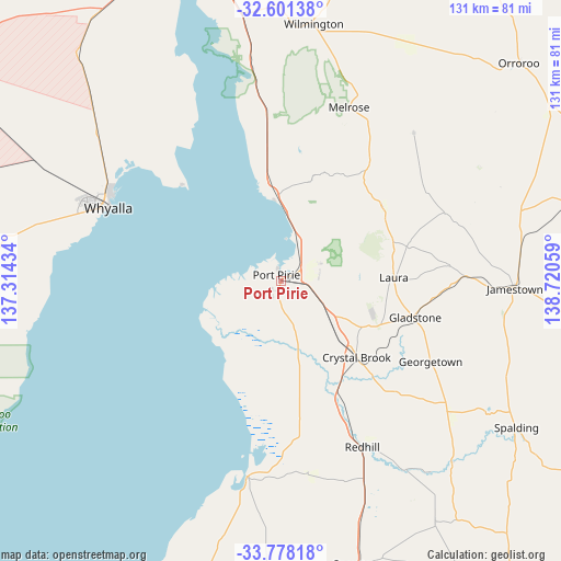
Port Pirie GPS coordinates[2]
33° 11' 30.336" South, 138° 1' 2.856" East
| Map corner | latitude | longitude |
|---|---|---|
| Upper-left | -32.60138°, | 137.31434° |
| Center: | -33.19176°, | 138.01746° |
| Lower-right: | -33.77818°, | 138.72059° |
| Map W x H: | 130.8×130.8 km | = 81.3×81.3mi |
| max Lat: | -10.58257° ⇑43.8% North |
| Port Pirie: | -33.19176° |
| min Lat: | ⇓56.2% South -43.31423° |
| min Long | Port Pirie | max Long |
| 113.53327° | 138.01746° | 153.61246° |
| W 14.6%⇐ | ⇒85.4% E |
Elevation
Elevation of Port Pirie is 7 m = 23 ft, and this is 115 m = 377 ft below average elevation for this country.
| Max E: |
1715 m = 5627 ft | 93.8% |
| Avg. | 122 m = 400 ft | |
| Port Pirie | 7 m = 23 ft | |
Min E: |
-2 m = -7 ft | 6.2% |
See also: Australia elevation on elevation.city.
Geographical zone
Port Pirie is located in South temperate zone (between Tropic of Capricorn and the Antarctic Circle). Distance of this Southern Tropic circle is 1084.7 km =674 mi to North.| Distance of | km | miles | from Port Pirie |
|---|---|---|---|
| Equator | 3690.6 | 2293.2 | to North |
| Tropic Capricorn | 1084.7 | 674 | to North |
| Antarctic Circle | 3710.6 | 2305.7 | to South |
| South Pole | 6316.5 | 3924.9 | to South |


Nearby cities:
15 places around Port Pirie: (largest is in red/bold)
• Crystal Brook
25.3 km =15.7 mi,  135°
135°
• Gladstone
32.6 km =20.3 mi,  104°
104°
• Laura
26.5 km =16.5 mi,  88°
88°
• Napperby
10 km =6.2 mi,  67°
67°
• Port Broughton
46.1 km =28.6 mi,  189°
189°
• Port Pirie South
0.7 km =0.4 mi,  202°
202°
• Port Pirie West
2.3 km =1.4 mi,  311°
311°
• Risdon Park
2.2 km =1.4 mi,  256°
256°
• Risdon Park South
3 km =1.9 mi,  224°
224°
• Solomontown
0.9 km =0.6 mi,  38°
38°
• Whyalla
45.7 km =28.4 mi,  292°
292°
• Whyalla Jenkins
50.7 km =31.5 mi, 291°
• Whyalla Norrie
48.1 km =29.9 mi, 292°
• Whyalla Playford
46.2 km =28.7 mi, 293°
• Whyalla Stuart
49.5 km =30.8 mi, 292°
Sources, notices
• [Note1] Compared only with cities in Australia existing in our database
• [Src1] Map data: © OpenStreetMap contributors (CC-BY-SA)
• [Src2] Other city data from geonames.org with taken over terms of usage.
• [Src3] Geographical zone / Annual Mean Temperature by Robert A. Rohde @ Wikipedia
