Caboolture South geodata
Caboolture South (Queensland) is a section of populated place; located in Australia in Australia/Brisbane (GMT+10) time zone. With population of 5,277 people, there are 1406 cities with bigger population in this country. Compared to other cities in Australia, 85.4% of cities are located further ↓South; 89.5% of cities are located further ←West and 81.9% of cities have higher elevation than Caboolture South. Note1


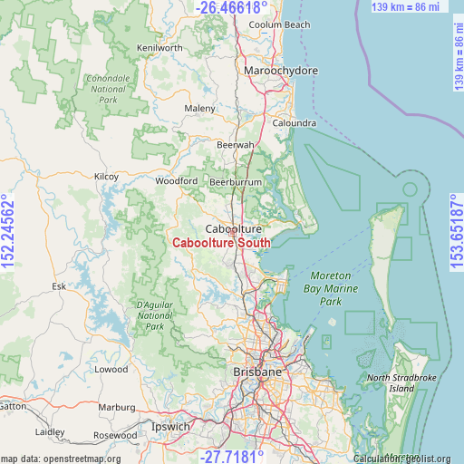
Caboolture South GPS coordinates[2]
27° 5' 38.004" South, 152° 56' 55.464" East
| Map corner | latitude | longitude |
|---|---|---|
| Upper-left | -26.46618°, | 152.24562° |
| Center: | -27.09389°, | 152.94874° |
| Lower-right: | -27.7181°, | 153.65187° |
| Map W x H: | 139.2×139.2 km | = 86.5×86.5mi |
| max Lat: | -10.58257° ⇑14.6% North |
| Caboolture South: | -27.09389° |
| min Lat: | ⇓85.4% South -43.31423° |
| min Long | Caboolture Sout | max Long |
| 113.53327° | 152.94874° | 153.61246° |
| W 89.5%⇐ | ⇒10.5% E |
Elevation
Elevation of Caboolture South is 14 m = 46 ft, and this is 108 m = 354 ft below average elevation for this country.
| Max E: |
1715 m = 5627 ft | 81.9% |
| Avg. | 122 m = 400 ft | |
| Caboolture South | 14 m = 46 ft | |
Min E: |
-2 m = -7 ft | 18.1% |
See also: Australia elevation on elevation.city.
Geographical zone
Caboolture South is located in South temperate zone (between Tropic of Capricorn and the Antarctic Circle). Distance of this Southern Tropic circle is 406.6 km =252.6 mi to North.| Distance of | km | miles | from Caboolture South |
|---|---|---|---|
| Equator | 3012.6 | 1871.9 | to North |
| Tropic Capricorn | 406.6 | 252.6 | to North |
| Antarctic Circle | 4388.6 | 2726.9 | to South |
| South Pole | 6994.5 | 4346.2 | to South |


Nearby cities:
15 places around Caboolture South: (largest is in red/bold)
• Beachmere
10.9 km =6.8 mi,  110°
110°
• Beerburrum
15.2 km =9.4 mi,  2°
2°
• Bellmere
5.9 km =3.7 mi,  280°
280°
• Burpengary
7.1 km =4.4 mi,  172°
172°
• Burpengary East
7.6 km =4.7 mi,  138°
138°
• Caboolture
1.1 km =0.7 mi,  12°
12°
• Deception Bay
13.5 km =8.4 mi,  145°
145°
• Donnybrook
15.3 km =9.5 mi,  49°
49°
• Elimbah
8.6 km =5.3 mi, 0°
• Morayfield
1.7 km =1.1 mi,  178°
178°
• Narangba
12.2 km =7.6 mi, 175°
• Ningi
13.4 km =8.3 mi,  74°
74°
• Ocean View
14.7 km =9.1 mi,  255°
255°
• Upper Caboolture
7 km =4.3 mi,  248°
248°
• Wamuran
10.3 km =6.4 mi,  306°
306°
Sources, notices
• [Note1] Compared only with cities in Australia existing in our database
• [Src1] Map data: © OpenStreetMap contributors (CC-BY-SA)
• [Src2] Other city data from geonames.org with taken over terms of usage.
• [Src3] Geographical zone / Annual Mean Temperature by Robert A. Rohde @ Wikipedia
